

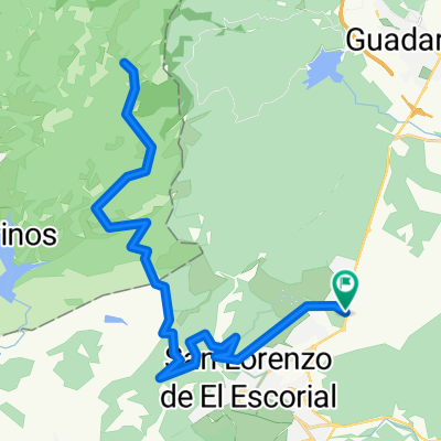
Silla de Felipe II- Malagon- Embalse Aceña-Peguerinos-Collado de la Mina-Abantos Norte-Silla de Felipe II
A cycling route starting in El Escorial, Madrid, Spain.
Overview
About this route
Silla de Felipe II- Malagon- Embalse Aceña-Peguerinos-Collado de la Mina-Abantos Norte-Silla de Felipe II
- -:--
- Duration
- 75 km
- Distance
- 1,475 m
- Ascent
- 1,474 m
- Descent
- ---
- Avg. speed
- ---
- Avg. speed

Route quality
Waytypes & surfaces along the route
Waytypes
Quiet road
39.5 km
(53 %)
Track
19.6 km
(26 %)
Surfaces
Paved
29 km
(39 %)
Unpaved
23.6 km
(31 %)
Asphalt
17.7 km
(24 %)
Unpaved (undefined)
10.3 km
(14 %)
Continue with Bikemap
Use, edit, or download this cycling route
You would like to ride Silla de Felipe II- Malagon- Embalse Aceña-Peguerinos-Collado de la Mina-Abantos Norte-Silla de Felipe II or customize it for your own trip? Here is what you can do with this Bikemap route:
Free features
- Save this route as favorite or in collections
- Copy & plan your own version of this route
- Sync your route with Garmin or Wahoo
Premium features
Free trial for 3 days, or one-time payment. More about Bikemap Premium.
- Navigate this route on iOS & Android
- Export a GPX / KML file of this route
- Create your custom printout (try it for free)
- Download this route for offline navigation
Discover more Premium features.
Get Bikemap PremiumFrom our community
Other popular routes starting in El Escorial
 Valla de los Caídos (cuelgamuros)
- Distance
- 12.7 km
- Ascent
- 481 m
- Descent
- 480 m
- Location
- El Escorial, Madrid, Spain
 Ruta San Lorenzo-La Jarosa-La Mina-Peñas Blancas-San Lorenzo
- Distance
- 48.1 km
- Ascent
- 1,104 m
- Descent
- 1,104 m
- Location
- El Escorial, Madrid, Spain
 Circular San Lorenzo-Jarosa-Peñota-Los Molinos
- Distance
- 42.7 km
- Ascent
- 731 m
- Descent
- 730 m
- Location
- El Escorial, Madrid, Spain
 El Escorial-Emb. de Valmayor-Valdemorillo
- Distance
- 46.8 km
- Ascent
- 402 m
- Descent
- 402 m
- Location
- El Escorial, Madrid, Spain
 Del Escorial a Cuatro Vientos
- Distance
- 61.1 km
- Ascent
- 495 m
- Descent
- 732 m
- Location
- El Escorial, Madrid, Spain
 el escorial machotas
- Distance
- 17.4 km
- Ascent
- 648 m
- Descent
- 648 m
- Location
- El Escorial, Madrid, Spain
 Circular San Lorenzo Escorial-Robledondo-Zarzalejo-Tomillar
- Distance
- 41.3 km
- Ascent
- 843 m
- Descent
- 843 m
- Location
- El Escorial, Madrid, Spain
 Tomillar - Peñas Blancas (cruce)
- Distance
- 42.4 km
- Ascent
- 929 m
- Descent
- 929 m
- Location
- El Escorial, Madrid, Spain
Open it in the app