

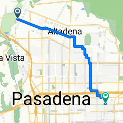
San Rafael Hills
A cycling route starting in La Cañada Flintridge, California, United States of America.
Overview
About this route
Good loopf for hill training.
The hill on Rancho San Rafael is one of the steepest around Pasadena.
A loop takes about 45min.
- -:--
- Duration
- 17.5 km
- Distance
- 686 m
- Ascent
- 662 m
- Descent
- ---
- Avg. speed
- 526 m
- Avg. speed
Route quality
Waytypes & surfaces along the route
Waytypes
Road
7.1 km
(41 %)
Quiet road
6.8 km
(39 %)
Surfaces
Paved
8.6 km
(49 %)
Asphalt
8.6 km
(49 %)
Undefined
8.9 km
(51 %)
Continue with Bikemap
Use, edit, or download this cycling route
You would like to ride San Rafael Hills or customize it for your own trip? Here is what you can do with this Bikemap route:
Free features
- Save this route as favorite or in collections
- Copy & plan your own version of this route
- Sync your route with Garmin or Wahoo
Premium features
Free trial for 3 days, or one-time payment. More about Bikemap Premium.
- Navigate this route on iOS & Android
- Export a GPX / KML file of this route
- Create your custom printout (try it for free)
- Download this route for offline navigation
Discover more Premium features.
Get Bikemap PremiumFrom our community
Other popular routes starting in La Cañada Flintridge
 Brown Mountain Trail, Altadena, CA
- Distance
- 10.5 km
- Ascent
- 847 m
- Descent
- 325 m
- Location
- La Cañada Flintridge, California, United States of America
 Relaxed route in Pasadena
- Distance
- 15.6 km
- Ascent
- 631 m
- Descent
- 666 m
- Location
- La Cañada Flintridge, California, United States of America
 La Cañada-Mt Wilson
- Distance
- 30.7 km
- Ascent
- 1,553 m
- Descent
- 229 m
- Location
- La Cañada Flintridge, California, United States of America
 mt wilson
- Distance
- 29.4 km
- Ascent
- 1,530 m
- Descent
- 235 m
- Location
- La Cañada Flintridge, California, United States of America
 Pasa Glen Drive 2899, Glendale to Pasa Glen Drive 2899, Glendale
- Distance
- 6.5 km
- Ascent
- 261 m
- Descent
- 267 m
- Location
- La Cañada Flintridge, California, United States of America
 Flintridge-Moint Disappointment
- Distance
- 29.2 km
- Ascent
- 1,492 m
- Descent
- 47 m
- Location
- La Cañada Flintridge, California, United States of America
 Easy ride in Pasadena
- Distance
- 11.5 km
- Ascent
- 365 m
- Descent
- 338 m
- Location
- La Cañada Flintridge, California, United States of America
 Hot Yoga
- Distance
- 10.1 km
- Ascent
- 21 m
- Descent
- 144 m
- Location
- La Cañada Flintridge, California, United States of America
Open it in the app