Premium Badge Download on the App Store Get it on Google Play Turn-by-turn Navigation Offline Maps Bike Type Optimized Routing Premium Maps Custom Bike Computer Export Routes Route Previews Fall Detection Premium Support

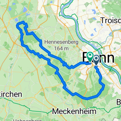
Cycling Route in Bonn, North Rhine-Westphalia, Germany

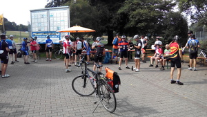
BRT2016-MO: Rund um den Flughafen - RTF des Radsportbezirk Mittelrhein-Süd beim BRT 2016 in Bonn - 65 km Strecke

5
Open this route in the Bikemap app

Open this route in the Bikemap app

Open this route in Bikemap Web

Open this route in Bikemap Web

64 km
Distance
149 m
Ascent
150 m
Descent
-:-- h
Duration
-- km/h
Avg. Speed
--- m
Max. Elevation

About This Route

BRT2016-MO: Rund um den Flughafen - 65 km

PSF (Pfeil-Such-Fahrt) des Radsportbezirk Mittelrhein-Süd beim BRT 2016 in Bonn

Alle weiteren Hinweise zu dieser Strecke -> hier anklicken

This cycling route is ideal for: Road bike

You will cycle on the following surfaces: Paved

Highlights Along The Route

POI Photo 1: Stefan Diwo

Drinking Water

Kontrolle <b>Altenrath</b><br>Ohne Navi war diese Kontrollstelle nicht ganz leicht zu finden, weil die Ausschilderung nach hier stark mangelhaft und irrführend war. Einige Fahrer der großen Runde fanden diese Kontrollstelle erst bei der 2. Anfahrt, weil sie vorher schon durch die Beschilderung in die große Schleife geleitet wurden.

POI Photo 2: Stefan Diwo

Drinking Water

Kontrolle <b>Uckendorf</b>

Customize this cycling route with the Bikemap route planner.

Make it yours!

Did you know? You can use this route as a template in our cycling route planner if you don't wish to start from scratch. Customize it based on your needs to plan your perfect cycling tour.

Open it in the app