

EDK 2016
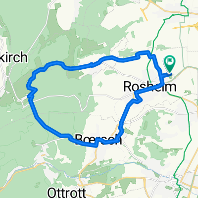
A cycling route starting in Rosheim, Alsace-Champagne-Ardenne-Lorraine, France.
Overview
About this route
Rosheim - Mont Saint Odile
- -:--
- Duration
- 22.8 km
- Distance
- 656 m
- Ascent
- 654 m
- Descent
- ---
- Avg. speed
- ---
- Avg. speed

Route highlights
Points of interest along the route

Point of interest after 0.7 km
Stacja 1
Point of interest after 2.4 km
Stacja 2
Point of interest after 3.8 km
Stacja 3
Point of interest after 6.9 km
Stacja 4 - krzyz
Point of interest after 7.8 km
Stacja 5 - Krzyz
Point of interest after 9.7 km
Stacja 6 - polana
Point of interest after 11 km
Stacja 7 - kaplica
Point of interest after 12.5 km
Stacja 8 - "ruiny"
Point of interest after 14.1 km
Stacja 9 - Krzyz
Point of interest after 15.3 km
Stacja 10 - Sw. Jakub
Point of interest after 17.9 km
Stacja 11 - tablica informacyjna
Point of interest after 20 km
Stacja 12 - Krzyz
Point of interest after 21.1 km
Stacja 13 - Winnice
Point of interest after 22 km
Stacja 14 -
Continue with Bikemap
Use, edit, or download this cycling route
You would like to ride EDK 2016 or customize it for your own trip? Here is what you can do with this Bikemap route:
Free features
- Save this route as favorite or in collections
- Copy & plan your own version of this route
- Sync your route with Garmin or Wahoo
Premium features
Free trial for 3 days, or one-time payment. More about Bikemap Premium.
- Navigate this route on iOS & Android
- Export a GPX / KML file of this route
- Create your custom printout (try it for free)
- Download this route for offline navigation
Discover more Premium features.
Get Bikemap PremiumFrom our community
Other popular routes starting in Rosheim
 EDK 2016
- Distance
- 22.8 km
- Ascent
- 656 m
- Descent
- 654 m
- Location
- Rosheim, Alsace-Champagne-Ardenne-Lorraine, France
 Rosheim-Boersch-Ottrot-Odilienberg
- Distance
- 12 km
- Ascent
- 627 m
- Descent
- 54 m
- Location
- Rosheim, Alsace-Champagne-Ardenne-Lorraine, France
 Rosheim
- Distance
- 18 km
- Ascent
- 291 m
- Descent
- 293 m
- Location
- Rosheim, Alsace-Champagne-Ardenne-Lorraine, France
 rte du vin - col de Fouchy - col de Steige
- Distance
- 112.4 km
- Ascent
- 1,761 m
- Descent
- 1,762 m
- Location
- Rosheim, Alsace-Champagne-Ardenne-Lorraine, France
 La Magel à partir de Rosheim
- Distance
- 38.4 km
- Ascent
- 757 m
- Descent
- 760 m
- Location
- Rosheim, Alsace-Champagne-Ardenne-Lorraine, France
 Rosheim - Strassburg
- Distance
- 34.1 km
- Ascent
- 109 m
- Descent
- 150 m
- Location
- Rosheim, Alsace-Champagne-Ardenne-Lorraine, France
 De Rue du Maire Schaffner 2, Rosheim à Rue du Maire Schaffner 1, Rosheim
- Distance
- 35.1 km
- Ascent
- 8 m
- Descent
- 13 m
- Location
- Rosheim, Alsace-Champagne-Ardenne-Lorraine, France
 Cote mille - Bruche - Champ de Feu - Odile
- Distance
- 88.7 km
- Ascent
- 1,814 m
- Descent
- 1,814 m
- Location
- Rosheim, Alsace-Champagne-Ardenne-Lorraine, France
Open it in the app