

Deggingen-Auhausen-Nellingen-Scharenstetten/Oppingen-Türkheim-Geislingen-Bad Überkingen-Deggingen
A cycling route starting in Deggingen, Baden-Württemberg, Germany.
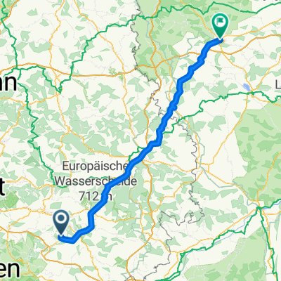
Overview
About this route
Landschaftlich sehr schöne Strecke - Rennrad
- -:--
- Duration
- 47 km
- Distance
- 529 m
- Ascent
- 567 m
- Descent
- ---
- Avg. speed
- 763 m
- Avg. speed
Route quality
Waytypes & surfaces along the route
Waytypes
Road
13.5 km
(29 %)
Busy road
13.4 km
(28 %)
Surfaces
Paved
35.1 km
(75 %)
Unpaved
1 km
(2 %)
Asphalt
33.7 km
(72 %)
Paved (undefined)
1.3 km
(3 %)
Continue with Bikemap
Use, edit, or download this cycling route
You would like to ride Deggingen-Auhausen-Nellingen-Scharenstetten/Oppingen-Türkheim-Geislingen-Bad Überkingen-Deggingen or customize it for your own trip? Here is what you can do with this Bikemap route:
Free features
- Save this route as favorite or in collections
- Copy & plan your own version of this route
- Sync your route with Garmin or Wahoo
Premium features
Free trial for 3 days, or one-time payment. More about Bikemap Premium.
- Navigate this route on iOS & Android
- Export a GPX / KML file of this route
- Create your custom printout (try it for free)
- Download this route for offline navigation
Discover more Premium features.
Get Bikemap PremiumFrom our community
Other popular routes starting in Deggingen
 Hausrunde
- Distance
- 51.4 km
- Ascent
- 552 m
- Descent
- 552 m
- Location
- Deggingen, Baden-Württemberg, Germany
 Trainingsroute "Alb" 5.4.09
- Distance
- 64.9 km
- Ascent
- 518 m
- Descent
- 518 m
- Location
- Deggingen, Baden-Württemberg, Germany
 Schwäb.Alb Galgenberg 20170518.gpx
- Distance
- 23.4 km
- Ascent
- 810 m
- Descent
- 806 m
- Location
- Deggingen, Baden-Württemberg, Germany
 Deggingen - Flugplatz Nortel
- Distance
- 13.3 km
- Ascent
- 231 m
- Descent
- 96 m
- Location
- Deggingen, Baden-Württemberg, Germany
 zügigen rund
- Distance
- 31.2 km
- Ascent
- 885 m
- Descent
- 866 m
- Location
- Deggingen, Baden-Württemberg, Germany
 rund um deggingen
- Distance
- 32.7 km
- Ascent
- 683 m
- Descent
- 650 m
- Location
- Deggingen, Baden-Württemberg, Germany
 Reichenbach nach Ansbach
- Distance
- 126.7 km
- Ascent
- 725 m
- Descent
- 808 m
- Location
- Deggingen, Baden-Württemberg, Germany
 Klein aber fein mit tollem Ausblick
- Distance
- 17.6 km
- Ascent
- 570 m
- Descent
- 570 m
- Location
- Deggingen, Baden-Württemberg, Germany
Open it in the app