

A Coffee + Architecture + Platting + Infrastructure + Beer Exploration
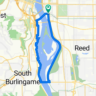
A cycling route starting in Portland, Oregon, United States of America.
Overview
About this route
Things we'll see/do.
We'll pass the Steel Bridge - 104 year old bridge that carries light rail, buses, pedestrians, bicycles, freight rail, passenger trains, and tractor trailors too. It's the work horse of Portland since 1912! Cup & Bar - one of the newest roasters in town, delivers by cargo bike, with open area to hang out/hack/bike to etc. Located by two of the new wonky crazy new residential towers going up. Ladd's Addition, one of the first neighborhoods, a planned streetcar neighborhood, of Portland platted and constructed between 1905 and 1930. Apex Bar/Brewery. Awesome bar with rocking tunes, more bike parking then you can imagine (and we'll still probably lock to trees) and an extremely impressive beer selection of local brews (dozens and dozens of them!). Tillikum Bridge is Portland's new transit, cycling, and pedestrian bridge. We'll route along some of the new MUP (Mixed Use Path) down to the bridge, where you'll get to see the confluence of streetcars, light rail, and buses funneling across the bridge and likely cyclists and pedestrians everywhere. It's a nifty bridge, just opened last year in September! We'll return along the southern end of the waterfront MUP (Mixed Use Path).- -:--
- Duration
- 9.9 km
- Distance
- 122 m
- Ascent
- 121 m
- Descent
- ---
- Avg. speed
- ---
- Avg. speed

Route quality
Waytypes & surfaces along the route
Waytypes
Quiet road
3.6 km
(36 %)
Path
2.6 km
(26 %)
Surfaces
Paved
8.8 km
(89 %)
Asphalt
4 km
(40 %)
Paved (undefined)
2.8 km
(28 %)
Continue with Bikemap
Use, edit, or download this cycling route
You would like to ride A Coffee + Architecture + Platting + Infrastructure + Beer Exploration or customize it for your own trip? Here is what you can do with this Bikemap route:
Free features
- Save this route as favorite or in collections
- Copy & plan your own version of this route
- Sync your route with Garmin or Wahoo
Premium features
Free trial for 3 days, or one-time payment. More about Bikemap Premium.
- Navigate this route on iOS & Android
- Export a GPX / KML file of this route
- Create your custom printout (try it for free)
- Download this route for offline navigation
Discover more Premium features.
Get Bikemap PremiumFrom our community
Other popular routes starting in Portland
 Sellwood Bridge Loop
- Distance
- 12.2 km
- Ascent
- 90 m
- Descent
- 87 m
- Location
- Portland, Oregon, United States of America
 Springwater/Mt. Tabor/Rocky Butte loop
- Distance
- 49.4 km
- Ascent
- 585 m
- Descent
- 588 m
- Location
- Portland, Oregon, United States of America
 Springwater Corridor
- Distance
- 40.2 km
- Ascent
- 236 m
- Descent
- 162 m
- Location
- Portland, Oregon, United States of America
 NW Kearney St, ポートランドへNW Kearney St, ポートランド
- Distance
- 80.8 km
- Ascent
- 955 m
- Descent
- 956 m
- Location
- Portland, Oregon, United States of America
 Kelley point FLAT route
- Distance
- 39.3 km
- Ascent
- 39 m
- Descent
- 101 m
- Location
- Portland, Oregon, United States of America
 Oswego Loop
- Distance
- 48.1 km
- Ascent
- 320 m
- Descent
- 325 m
- Location
- Portland, Oregon, United States of America
 Find the Gnomes from Rubber to the Road
- Distance
- 46.3 km
- Ascent
- 696 m
- Descent
- 695 m
- Location
- Portland, Oregon, United States of America
 Loop from Home to Columbia River and Around River
- Distance
- 39.3 km
- Ascent
- 160 m
- Descent
- 194 m
- Location
- Portland, Oregon, United States of America
Open it in the app