

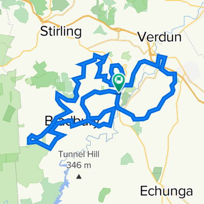
Stage 3 - Mylor Oval to Wittunga Botanic Gardens
A cycling route starting in Stirling, South Australia, Australia.
Overview
About this route
Great hills on this section. Morgan road is a challenge and coming down Ackland's hill is just great fun!
- -:--
- Duration
- 18.5 km
- Distance
- 355 m
- Ascent
- 420 m
- Descent
- ---
- Avg. speed
- ---
- Avg. speed

Route quality
Waytypes & surfaces along the route
Waytypes
Road
13.8 km
(74 %)
Busy road
3.6 km
(19 %)
Surfaces
Paved
17.9 km
(97 %)
Asphalt
14.7 km
(79 %)
Paved (undefined)
3.2 km
(17 %)
Undefined
0.6 km
(3 %)
Continue with Bikemap
Use, edit, or download this cycling route
You would like to ride Stage 3 - Mylor Oval to Wittunga Botanic Gardens or customize it for your own trip? Here is what you can do with this Bikemap route:
Free features
- Save this route as favorite or in collections
- Copy & plan your own version of this route
- Sync your route with Garmin or Wahoo
Premium features
Free trial for 3 days, or one-time payment. More about Bikemap Premium.
- Navigate this route on iOS & Android
- Export a GPX / KML file of this route
- Create your custom printout (try it for free)
- Download this route for offline navigation
Discover more Premium features.
Get Bikemap PremiumFrom our community
Other popular routes starting in Stirling
 Stage 3 - Mylor Oval to Wittunga Botanic Gardens
- Distance
- 18.5 km
- Ascent
- 355 m
- Descent
- 420 m
- Location
- Stirling, South Australia, Australia
 Mount Barker Road 220, Aldgate to Unnamed Road, Ironbank
- Distance
- 8.2 km
- Ascent
- 110 m
- Descent
- 115 m
- Location
- Stirling, South Australia, Australia
 309–315 Strathalbyn Rd, Mylor nach 387 Mount Barker Rd, Bridgewater
- Distance
- 8.4 km
- Ascent
- 689 m
- Descent
- 614 m
- Location
- Stirling, South Australia, Australia
 Mylor to Aldgate Loop
- Distance
- 10.2 km
- Ascent
- 239 m
- Descent
- 239 m
- Location
- Stirling, South Australia, Australia
 Mylor to Mylor
- Distance
- 50.6 km
- Ascent
- 804 m
- Descent
- 804 m
- Location
- Stirling, South Australia, Australia
 Mylor to Rocky Creek 2/10
- Distance
- 33.8 km
- Ascent
- 367 m
- Descent
- 369 m
- Location
- Stirling, South Australia, Australia
 Steady ride in Crafers
- Distance
- 10.2 km
- Ascent
- 316 m
- Descent
- 99 m
- Location
- Stirling, South Australia, Australia
 Summit & Basket Range
- Distance
- 50.2 km
- Ascent
- 631 m
- Descent
- 631 m
- Location
- Stirling, South Australia, Australia
Open it in the app