

Giro degli Castelli
A cycling route starting in San Piero in Bagno, Emilia-Romagna, Italy.
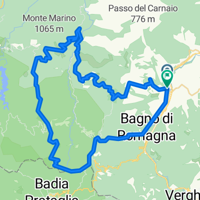
Overview
About this route
Mittelschwere Tour mit dem kulturellen Höhepunkt in San Leo
- -:--
- Duration
- 111.2 km
- Distance
- 3,167 m
- Ascent
- 3,503 m
- Descent
- ---
- Avg. speed
- 1,139 m
- Avg. speed
Route quality
Waytypes & surfaces along the route
Waytypes
Busy road
75 km
(67 %)
Road
28.5 km
(26 %)
Surfaces
Paved
91.4 km
(82 %)
Unpaved
0.1 km
(<1 %)
Asphalt
91.4 km
(82 %)
Loose gravel
0.1 km
(<1 %)
Undefined
19.7 km
(18 %)
Continue with Bikemap
Use, edit, or download this cycling route
You would like to ride Giro degli Castelli or customize it for your own trip? Here is what you can do with this Bikemap route:
Free features
- Save this route as favorite or in collections
- Copy & plan your own version of this route
- Sync your route with Garmin or Wahoo
Premium features
Free trial for 3 days, or one-time payment. More about Bikemap Premium.
- Navigate this route on iOS & Android
- Export a GPX / KML file of this route
- Create your custom printout (try it for free)
- Download this route for offline navigation
Discover more Premium features.
Get Bikemap PremiumFrom our community
Other popular routes starting in San Piero in Bagno
 San Pietro in Bagno - Camaldoli
- Distance
- 35.9 km
- Ascent
- 889 m
- Descent
- 621 m
- Location
- San Piero in Bagno, Emilia-Romagna, Italy
 p21 Passo dei Mandrioli
- Distance
- 28.5 km
- Ascent
- 1,053 m
- Descent
- 1,168 m
- Location
- San Piero in Bagno, Emilia-Romagna, Italy
 San Piero in Bagno-Passo dei Mandrioli-Foresta della Lama-Ridracoli
- Distance
- 37.3 km
- Ascent
- 864 m
- Descent
- 1,047 m
- Location
- San Piero in Bagno, Emilia-Romagna, Italy
 2018 Assisi 6. dan (San Pietro in Bagno - Citta di Castello)
- Distance
- 90.2 km
- Ascent
- 1,444 m
- Descent
- 1,654 m
- Location
- San Piero in Bagno, Emilia-Romagna, Italy
 San Piero in Bagno - Corzano - Pian dei Riti - Gallerie
- Distance
- 25.4 km
- Ascent
- 1,099 m
- Descent
- 1,098 m
- Location
- San Piero in Bagno, Emilia-Romagna, Italy
 casentino forestale
- Distance
- 47.2 km
- Ascent
- 1,534 m
- Descent
- 1,537 m
- Location
- San Piero in Bagno, Emilia-Romagna, Italy
 Chiar d'Ovo con variante iniziale
- Distance
- 18.6 km
- Ascent
- 822 m
- Descent
- 822 m
- Location
- San Piero in Bagno, Emilia-Romagna, Italy
 Around Bagno di Romagna 2
- Distance
- 120.4 km
- Ascent
- 2,770 m
- Descent
- 2,770 m
- Location
- San Piero in Bagno, Emilia-Romagna, Italy
Open it in the app