

SF Tour 2016 route
A cycling route starting in Kokkola, Central Ostrobothnia, Finland.
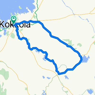
Overview
About this route
Kokkola - Helsinki
676 km
Kokkola 3.7 Day 1 start
Ylihärmä 4.7 Day 2 start
Kauhajaoki 5.7 Day 3 start
Ikaalinen 6.7 Day 4 start
Sastamala 7.7 Day 5 start
Forssa 8.7 Day 6 start
Karkkila 9.7 Day 7 start
Helsinki 9.7 Finish
- -:--
- Duration
- 676.7 km
- Distance
- 384 m
- Ascent
- 376 m
- Descent
- ---
- Avg. speed
- ---
- Avg. speed

Route quality
Waytypes & surfaces along the route
Waytypes
Road
245.5 km
(36 %)
Cycleway
183 km
(27 %)
Surfaces
Paved
521 km
(77 %)
Unpaved
52.2 km
(8 %)
Asphalt
441.9 km
(65 %)
Paved (undefined)
78.4 km
(12 %)
Continue with Bikemap
Use, edit, or download this cycling route
You would like to ride SF Tour 2016 route or customize it for your own trip? Here is what you can do with this Bikemap route:
Free features
- Save this route as favorite or in collections
- Copy & plan your own version of this route
- Sync your route with Garmin or Wahoo
Premium features
Free trial for 3 days, or one-time payment. More about Bikemap Premium.
- Navigate this route on iOS & Android
- Export a GPX / KML file of this route
- Create your custom printout (try it for free)
- Download this route for offline navigation
Discover more Premium features.
Get Bikemap PremiumFrom our community
Other popular routes starting in Kokkola
 Kokkola-Seljes-Kaustinen-Ullava-Kälviä-Kokkola
- Distance
- 135 km
- Ascent
- 191 m
- Descent
- 186 m
- Location
- Kokkola, Central Ostrobothnia, Finland
 Nauti merituulesta ja saaristomaisemista Öjan pyöräilyreitillä - Nauti merituulesta ja saaristomaisemista Öjan pyöräilyreitillä
- Distance
- 36.1 km
- Ascent
- 150 m
- Descent
- 148 m
- Location
- Kokkola, Central Ostrobothnia, Finland
 Sateenkaari - Saarenkangas
- Distance
- 29.5 km
- Ascent
- 16 m
- Descent
- 16 m
- Location
- Kokkola, Central Ostrobothnia, Finland
 Raahenkatu-Larsmo-Pietarsaari-Kolppi-Åsbackantie-Sandbacka-Sokoja-Raahenkatu
- Distance
- 121.2 km
- Ascent
- 77 m
- Descent
- 73 m
- Location
- Kokkola, Central Ostrobothnia, Finland
 Kokkola-Sandbacka-Kruunupyy-Edsevö-Pietarsaari-Larsmo-Ykspihlaja-Kokkola
- Distance
- 85.1 km
- Ascent
- 64 m
- Descent
- 64 m
- Location
- Kokkola, Central Ostrobothnia, Finland
 Laajalahti
- Distance
- 21.1 km
- Ascent
- 24 m
- Descent
- 22 m
- Location
- Kokkola, Central Ostrobothnia, Finland
 Santahaka-Harriniemi-Kvikant
- Distance
- 24.5 km
- Ascent
- 4 m
- Descent
- 6 m
- Location
- Kokkola, Central Ostrobothnia, Finland
 Santahaka-Harriniemi-Kvikant
- Distance
- 24.5 km
- Ascent
- 4 m
- Descent
- 6 m
- Location
- Kokkola, Central Ostrobothnia, Finland
Open it in the app