

Csárda túra MTB 55km (2016)
A cycling route starting in Komárno, Nitriansky kraj, Slovak Republic.
Overview
About this route
MTB" táv 55 km
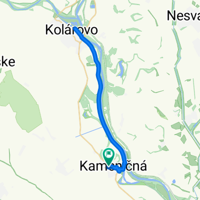
Komárom - Izsa - Zsitvafő - Szilos - Marcelháza - Izsa - Harcsás -Komárom
Szintkülönbség: 100 méter, szintidő: 6 óra.
Az utolsó 6. ellenőrző pont ÖNELLÁTÓ!
Trať „MTB" 55 km
Komárno - Iža - Žitava - Šrobárová - Marcelová - Iža - Harčáš - Komárno
Prevýšenie: 100 metrov, max. doba: 6 hodín
Posledny 6. kontrolný bod je SAMOOBSLUZNÝ!
- -:--
- Duration
- 54.9 km
- Distance
- 155 m
- Ascent
- 154 m
- Descent
- ---
- Avg. speed
- ---
- Avg. speed

Route highlights
Points of interest along the route
Point of interest after 3.8 km
1. EP - Dunapart / 7:10 - 10:30 / 3,8km - Breh Dunaja funguje medzi 7:15 - 10:30 - között múködik
Point of interest after 10.7 km
2.EP - 10km Izsa vége - kerékpáros pihenő a töltésen - Iza - cyklistické odpocívadlo na hrádzy funguje medzi 07:25 - 10:45 között működik
Point of interest after 28 km
3.EP - 27km FRISSITŐÁLLOMÁS-OBCERSTVOVACIA STANICA Homokbánya - tó / Piesková bana - jazero funguje medzi 7:45 - 12:30 között működik
Point of interest after 35.4 km
4.EP - 35km Erdő széle - Vstup do lesa funguje medzi 8:00 - 13:00 között működik
Point of interest after 40.5 km
4.EP - 40,3km FRISSÍTŐ ÁLLOMÁS - OBCERSTV. STANICA Marcelháza - Marcelová V Pohostinstve - LIPA - kocsmában
Point of interest after 49.9 km
6. EP - 50km ÖNELLÁTÓ - SAMOOBSLUHA Harcsás előtt - beton villanyoszlop Pred Harcásom - betonový stlp elektr. vedenia.
Continue with Bikemap
Use, edit, or download this cycling route
You would like to ride Csárda túra MTB 55km (2016) or customize it for your own trip? Here is what you can do with this Bikemap route:
Free features
- Save this route as favorite or in collections
- Copy & plan your own version of this route
- Sync your route with Garmin or Wahoo
Premium features
Free trial for 3 days, or one-time payment. More about Bikemap Premium.
- Navigate this route on iOS & Android
- Export a GPX / KML file of this route
- Create your custom printout (try it for free)
- Download this route for offline navigation
Discover more Premium features.
Get Bikemap PremiumFrom our community
Other popular routes starting in Komárno
 PBM - MTB56
- Distance
- 54 km
- Ascent
- 15 m
- Descent
- 18 m
- Location
- Komárno, Nitriansky kraj, Slovak Republic
 Csarda túra MTB 55
- Distance
- 53.4 km
- Ascent
- 137 m
- Descent
- 138 m
- Location
- Komárno, Nitriansky kraj, Slovak Republic
 KidCup - MINI + BABY
- Distance
- 0.5 km
- Ascent
- 0 m
- Descent
- 5 m
- Location
- Komárno, Nitriansky kraj, Slovak Republic
 Csarda Túra EXTREME 110km
- Distance
- 107.7 km
- Ascent
- 245 m
- Descent
- 248 m
- Location
- Komárno, Nitriansky kraj, Slovak Republic
 Recovered Route
- Distance
- 19.3 km
- Ascent
- 54 m
- Descent
- 67 m
- Location
- Komárno, Nitriansky kraj, Slovak Republic
 Z10 Komarno - Tata
- Distance
- 74.4 km
- Ascent
- 119 m
- Descent
- 122 m
- Location
- Komárno, Nitriansky kraj, Slovak Republic
 Around Komárno (2010)
- Distance
- 16.2 km
- Ascent
- 41 m
- Descent
- 41 m
- Location
- Komárno, Nitriansky kraj, Slovak Republic
 Kameničná, Keszegfalva - Kameničná, Keszegfalva
- Distance
- 29.1 km
- Ascent
- 38 m
- Descent
- 36 m
- Location
- Komárno, Nitriansky kraj, Slovak Republic
Open it in the app