

The Washington & Old Dominion Trail
A cycling route starting in Dunn Loring, Virginia, United States of America.
Overview
About this route
The Washington & Old Dominion Trail (W&OD or "Wad") is a great rail trail through the Northern Virginia counties. The entire 45 miles is paved with nine foot wide asphalt and has a painted yellow center line. There is also a parallel horse trail along much of the trail (which can be a nice diversion for ATBs). The only real complaints about this trail are its popularity (it can be quite crowded on some days) and the fact that much of it follows a power line right-of-way
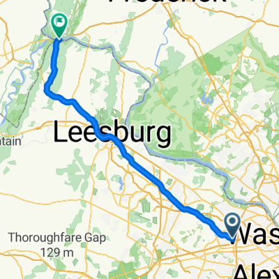
The W&OD Trail begins in the Shirlington area of Arlington County, just off I-395 Exit 6. It ends "way-out" in rural Purcellville, VA. Along the way, it passes through quaint villages like Falls Church and Leesburg, and high-tech centers such as Reston and Herndon.
- -:--
- Duration
- 96.5 km
- Distance
- 379 m
- Ascent
- 390 m
- Descent
- ---
- Avg. speed
- ---
- Avg. speed
Route quality
Waytypes & surfaces along the route
Waytypes
Cycleway
94.8 km
(98 %)
Quiet road
0.6 km
(<1 %)
Surfaces
Paved
94.6 km
(98 %)
Unpaved
1.2 km
(1 %)
Asphalt
92.5 km
(96 %)
Concrete
1.6 km
(2 %)
Continue with Bikemap
Use, edit, or download this cycling route
You would like to ride The Washington & Old Dominion Trail or customize it for your own trip? Here is what you can do with this Bikemap route:
Free features
- Save this route as favorite or in collections
- Copy & plan your own version of this route
- Sync your route with Garmin or Wahoo
Premium features
Free trial for 3 days, or one-time payment. More about Bikemap Premium.
- Navigate this route on iOS & Android
- Export a GPX / KML file of this route
- Create your custom printout (try it for free)
- Download this route for offline navigation
Discover more Premium features.
Get Bikemap PremiumFrom our community
Other popular routes starting in Dunn Loring
 2414–2422 Holt St, Vienna to Jefferson Pike, Purcellville
- Distance
- 75.1 km
- Ascent
- 374 m
- Descent
- 401 m
- Location
- Dunn Loring, Virginia, United States of America
 2547 Gallows Rd, Dunn Loring to 2670 Avenir Pl, Vienna
- Distance
- 24.7 km
- Ascent
- 143 m
- Descent
- 147 m
- Location
- Dunn Loring, Virginia, United States of America
 part of my ride whoops 20mi on 6/1
- Distance
- 17.9 km
- Ascent
- 119 m
- Descent
- 187 m
- Location
- Dunn Loring, Virginia, United States of America
 Home to the embassy
- Distance
- 22.6 km
- Ascent
- 149 m
- Descent
- 220 m
- Location
- Dunn Loring, Virginia, United States of America
 Route from Sandburg St, Dunn Loring
- Distance
- 9.2 km
- Ascent
- 41 m
- Descent
- 106 m
- Location
- Dunn Loring, Virginia, United States of America
 Bike to work
- Distance
- 9.8 km
- Ascent
- 56 m
- Descent
- 109 m
- Location
- Dunn Loring, Virginia, United States of America
 Recovered Route
- Distance
- 233.9 km
- Ascent
- 146 m
- Descent
- 208 m
- Location
- Dunn Loring, Virginia, United States of America
 2367 Cedar Ln, Vienna to 1000 E Broad St, Falls Church
- Distance
- 9.7 km
- Ascent
- 76 m
- Descent
- 93 m
- Location
- Dunn Loring, Virginia, United States of America
Open it in the app