

Katia & Pascal, cortège
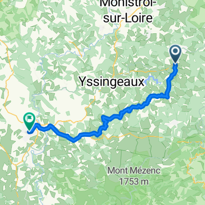
A cycling route starting in Montfaucon-en-Velay, Auvergne-Rhône-Alpes, France.
Overview
About this route
<3
- -:--
- Duration
- 13.2 km
- Distance
- 247 m
- Ascent
- 240 m
- Descent
- ---
- Avg. speed
- ---
- Avg. speed
Route quality
Waytypes & surfaces along the route
Waytypes
Busy road
9.5 km
(72 %)
Quiet road
3.5 km
(27 %)
Surfaces
Paved
3.4 km
(26 %)
Asphalt
3.4 km
(26 %)
Undefined
9.7 km
(74 %)
Route highlights
Points of interest along the route
Point of interest after 3.3 km
Aulagny
Continue with Bikemap
Use, edit, or download this cycling route
You would like to ride Katia & Pascal, cortège or customize it for your own trip? Here is what you can do with this Bikemap route:
Free features
- Save this route as favorite or in collections
- Copy & plan your own version of this route
- Sync your route with Garmin or Wahoo
Premium features
Free trial for 3 days, or one-time payment. More about Bikemap Premium.
- Navigate this route on iOS & Android
- Export a GPX / KML file of this route
- Create your custom printout (try it for free)
- Download this route for offline navigation
Discover more Premium features.
Get Bikemap PremiumFrom our community
Other popular routes starting in Montfaucon-en-Velay
 2023 Bahntrasse Dunieres----Riotard
- Distance
- 34.7 km
- Ascent
- ---
- Descent
- ---
- Location
- Montfaucon-en-Velay, Auvergne-Rhône-Alpes, France
 Montregard, Riotord, St Julien, St Bonnet
- Distance
- 50.6 km
- Ascent
- 716 m
- Descent
- 716 m
- Location
- Montfaucon-en-Velay, Auvergne-Rhône-Alpes, France
 215 Route de la Gare, Raucoules nach 54bis Grande Rue, St.-Pierre-de-Boeuf
- Distance
- 53 km
- Ascent
- 475 m
- Descent
- 1,167 m
- Location
- Montfaucon-en-Velay, Auvergne-Rhône-Alpes, France
 43 La Gare Raucoules à La Maisonneuve, Riotord tunnel fermé
- Distance
- 19 km
- Ascent
- 333 m
- Descent
- 289 m
- Location
- Montfaucon-en-Velay, Auvergne-Rhône-Alpes, France
 Pont de Raucoules
- Distance
- 19.3 km
- Ascent
- 1,574 m
- Descent
- 735 m
- Location
- Montfaucon-en-Velay, Auvergne-Rhône-Alpes, France
 Mountfaucon - Le Puy en Velay Teil 4
- Distance
- 56.4 km
- Ascent
- 615 m
- Descent
- 889 m
- Location
- Montfaucon-en-Velay, Auvergne-Rhône-Alpes, France
 Montregard, Col de la Charousse
- Distance
- 104.8 km
- Ascent
- 1,453 m
- Descent
- 1,454 m
- Location
- Montfaucon-en-Velay, Auvergne-Rhône-Alpes, France
 St Bonnet-Montpoulet
- Distance
- 35.1 km
- Ascent
- 898 m
- Descent
- 1,363 m
- Location
- Montfaucon-en-Velay, Auvergne-Rhône-Alpes, France
Open it in the app