

NL The Rhine Cycle Route
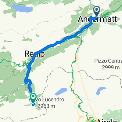
A cycling route starting in Andermatt, Canton of Uri, Switzerland.
Overview
About this route
The Rhine Cycle Route is about 1,360 meters long and leads you through five countries. The track starts in the Swiss alps - the headwater area of the Rhine. Then it passes Austria, France and Germany. The route ends in Rotterdam in the Netherlands where the Rhine flows into the North Sea. (cloned from route 2567738) Tourbook: Kompass: Rheinradweg 1 - ISBN: 978-3-8502-6642-0
- -:--
- Duration
- 1,352.1 km
- Distance
- 88 m
- Ascent
- 1,523 m
- Descent
- ---
- Avg. speed
- ---
- Avg. speed
Route quality
Waytypes & surfaces along the route
Waytypes
Quiet road
335.6 km
(25 %)
Track
282.2 km
(21 %)
Surfaces
Paved
1,023.2 km
(76 %)
Unpaved
214.8 km
(16 %)
Asphalt
902.9 km
(67 %)
Gravel
139.4 km
(10 %)
Route highlights
Points of interest along the route
Point of interest after 293.6 km
The Rhine Falls (Rheinfall in German) is the largest plain waterfall in Europe. They are 150 m wide and 23 m high.
Point of interest after 667.2 km
Speyer is one of the oldest cities in Germany and is therefore historically and culturally important. Most famous is the Imperial Cathedral of Speyer
Point of interest after 829.8 km
The Lorelei is a rock on the eastern bank of the Rhine which soars some 120 metres above the waterline. It marks the narrowest part of the river between Switzerland and the North Sea, and is the most famous feature of the Rhine Gorge, a 65 km section of the river between Koblenz and Bingen that was
Point of interest after 893.7 km
One of Andernach's natural attractions is the world's highest (max. 64 m) cold-water geyser, driven by carbon dioxide with force generated in a fashion similar to that in a shaken bottle of table water.
Continue with Bikemap
Use, edit, or download this cycling route
You would like to ride NL The Rhine Cycle Route or customize it for your own trip? Here is what you can do with this Bikemap route:
Free features
- Save this route as favorite or in collections
- Copy & plan your own version of this route
- Sync your route with Garmin or Wahoo
Premium features
Free trial for 3 days, or one-time payment. More about Bikemap Premium.
- Navigate this route on iOS & Android
- Export a GPX / KML file of this route
- Create your custom printout (try it for free)
- Download this route for offline navigation
Discover more Premium features.
Get Bikemap PremiumFrom our community
Other popular routes starting in Andermatt
 Transalpine (7) Andermatt - Visp
- Distance
- 89.5 km
- Ascent
- 1,685 m
- Descent
- 2,290 m
- Location
- Andermatt, Canton of Uri, Switzerland
 Furka-Nufenen-Gotthard-Oberalp
- Distance
- 135.9 km
- Ascent
- 4,637 m
- Descent
- 4,527 m
- Location
- Andermatt, Canton of Uri, Switzerland
 giro dei tre passi susten grimsel furka
- Distance
- 132.9 km
- Ascent
- 3,457 m
- Descent
- 3,601 m
- Location
- Andermatt, Canton of Uri, Switzerland
![[DAY 19] Göschenen - Ilanz](https://media.bikemap.net/routes/8561780/gallery/thumbs/af10c4bc-a85d-4013-8c11-c6c25ccc528a.jpeg.208x208_q80_crop.jpg) [DAY 19] Göschenen - Ilanz
[DAY 19] Göschenen - Ilanz- Distance
- 68.1 km
- Ascent
- 984 m
- Descent
- 1,380 m
- Location
- Andermatt, Canton of Uri, Switzerland
 VR01 Furkapass Belvedere-Brig.kml - VR01 Furkapass Belvedere-Brig.kml_VR01 Furkapass Belvedere-Brig
- Distance
- 60.1 km
- Ascent
- 852 m
- Descent
- 2,409 m
- Location
- Andermatt, Canton of Uri, Switzerland
 Witenwasseren Bike
- Distance
- 17.3 km
- Ascent
- 808 m
- Descent
- 26 m
- Location
- Andermatt, Canton of Uri, Switzerland
 NL The Rhine Cycle Route
- Distance
- 1,352.1 km
- Ascent
- 88 m
- Descent
- 1,523 m
- Location
- Andermatt, Canton of Uri, Switzerland
 20.09.2010 Furka, Nufenen, Gotthard
- Distance
- 98.5 km
- Ascent
- 2,959 m
- Descent
- 2,959 m
- Location
- Andermatt, Canton of Uri, Switzerland
Open it in the app