Premium Badge Download on the App Store Get it on Google Play Turn-by-turn Navigation Offline Maps Bike Type Optimized Routing Premium Maps Custom Bike Computer Export Routes Route Previews Fall Detection Premium Support

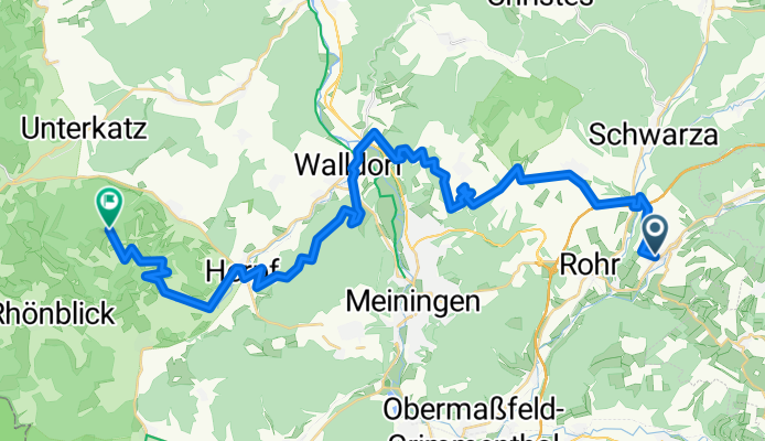
Cycling Route in Dillstädt, Free State of Thuringia, Germany

Hohe Geba (Hinweg)

0
Open this route in the Bikemap app

Open this route in the Bikemap app

Open this route in Bikemap Web

Open this route in Bikemap Web

39 km
Distance
960 m
Ascent
609 m
Descent
-:-- h
Duration
-- km/h
Avg. Speed
--- m
Max. Elevation

About This Route

1.035 Hm auf 40 km Anfahrt zur Hohen Geba-der schwerste Teil war der zwischen Walldorf und Herpf-3,5 km aufwärts-da ging es zur Sache-zum Glück war der Weg jetzt geschottert-runter war es extrem-die Holzmacher waren wieder im Einsatz gewesen-zur Geba hoch bin ich über Seeba und Träbes auf meinem Lieblingsweg (auf dem gibt es keine extremen Überhöhungen)

This cycling route is ideal for: MTB

You will cycle on the following surfaces: Unpaved Gravel

Customize this cycling route with the Bikemap route planner.

Make it yours!

Did you know? You can use this route as a template in our cycling route planner if you don't wish to start from scratch. Customize it based on your needs to plan your perfect cycling tour.

Open it in the app