

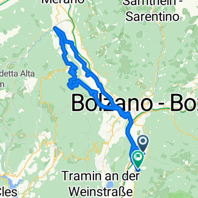
RR Leifers - Deutschnofen
A cycling route starting in Laives, Trentino-Alto Adige, Italy.
Overview
About this route
via Karneid und Gummer
- -:--
- Duration
- 75.8 km
- Distance
- 1,752 m
- Ascent
- 1,750 m
- Descent
- ---
- Avg. speed
- ---
- Avg. speed

Route quality
Waytypes & surfaces along the route
Waytypes
Busy road
26.1 km
(34 %)
Quiet road
20.8 km
(27 %)
Surfaces
Paved
45.1 km
(60 %)
Unpaved
2 km
(3 %)
Asphalt
45 km
(59 %)
Gravel
1 km
(1 %)
Continue with Bikemap
Use, edit, or download this cycling route
You would like to ride RR Leifers - Deutschnofen or customize it for your own trip? Here is what you can do with this Bikemap route:
Free features
- Save this route as favorite or in collections
- Copy & plan your own version of this route
- Sync your route with Garmin or Wahoo
Premium features
Free trial for 3 days, or one-time payment. More about Bikemap Premium.
- Navigate this route on iOS & Android
- Export a GPX / KML file of this route
- Create your custom printout (try it for free)
- Download this route for offline navigation
Discover more Premium features.
Get Bikemap PremiumFrom our community
Other popular routes starting in Laives
 Leifers-Lago di Caldaro-Weinstraße-Monticolo
- Distance
- 39 km
- Ascent
- 666 m
- Descent
- 663 m
- Location
- Laives, Trentino-Alto Adige, Italy
 CAVALLERIA PESANTE
- Distance
- 70.6 km
- Ascent
- 997 m
- Descent
- 957 m
- Location
- Laives, Trentino-Alto Adige, Italy
 Laives-Nova Ponente-OCLINI-Redagno-Bronx
- Distance
- 65.8 km
- Ascent
- 1,837 m
- Descent
- 1,852 m
- Location
- Laives, Trentino-Alto Adige, Italy
 Laives-Lana-Prissian-Grissian-Andriano-Bronx
- Distance
- 80.3 km
- Ascent
- 932 m
- Descent
- 896 m
- Location
- Laives, Trentino-Alto Adige, Italy
 Leifers - Trento
- Distance
- 55.1 km
- Ascent
- 185 m
- Descent
- 215 m
- Location
- Laives, Trentino-Alto Adige, Italy
 Giro di KiKa 2014
- Distance
- 1,013.4 km
- Ascent
- 8,606 m
- Descent
- 8,606 m
- Location
- Laives, Trentino-Alto Adige, Italy
 Von Leifers bis Porto Tolle
- Distance
- 315.4 km
- Ascent
- 1,707 m
- Descent
- 1,953 m
- Location
- Laives, Trentino-Alto Adige, Italy
 salita vadena
- Distance
- 32.1 km
- Ascent
- 567 m
- Descent
- 568 m
- Location
- Laives, Trentino-Alto Adige, Italy
Open it in the app