

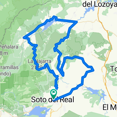
soto-la trampa-bustaviejo-canencia-morcuera
A cycling route starting in Miraflores de la Sierra, Madrid, Spain.
Overview
About this route
ruta montañosa
- -:--
- Duration
- 121.6 km
- Distance
- 1,754 m
- Ascent
- 1,755 m
- Descent
- ---
- Avg. speed
- ---
- Avg. speed
Route quality
Waytypes & surfaces along the route
Waytypes
Busy road
66.6 km
(55 %)
Road
36.1 km
(30 %)
Surfaces
Paved
24 km
(20 %)
Unpaved
1.6 km
(1 %)
Asphalt
15.8 km
(13 %)
Paved (undefined)
8.2 km
(7 %)
Continue with Bikemap
Use, edit, or download this cycling route
You would like to ride soto-la trampa-bustaviejo-canencia-morcuera or customize it for your own trip? Here is what you can do with this Bikemap route:
Free features
- Save this route as favorite or in collections
- Copy & plan your own version of this route
- Sync your route with Garmin or Wahoo
Premium features
Free trial for 3 days, or one-time payment. More about Bikemap Premium.
- Navigate this route on iOS & Android
- Export a GPX / KML file of this route
- Create your custom printout (try it for free)
- Download this route for offline navigation
Discover more Premium features.
Get Bikemap PremiumFrom our community
Other popular routes starting in Miraflores de la Sierra
 Ruta Sierra 03: 88 Km 1687 m - "Morcuera y Cotos"
- Distance
- 86.4 km
- Ascent
- 1,588 m
- Descent
- 1,589 m
- Location
- Miraflores de la Sierra, Madrid, Spain
 Picos
Picos- Distance
- 15.7 km
- Ascent
- 891 m
- Descent
- 891 m
- Location
- Miraflores de la Sierra, Madrid, Spain
 Miraflores-Canencia-Rascafria-Morcuera-Miraflores
- Distance
- 100.9 km
- Ascent
- 1,689 m
- Descent
- 1,689 m
- Location
- Miraflores de la Sierra, Madrid, Spain
 Miraflores-Morcuera-Rascafría-Majada Cojo 07.07.12
- Distance
- 57.2 km
- Ascent
- 1,333 m
- Descent
- 1,333 m
- Location
- Miraflores de la Sierra, Madrid, Spain
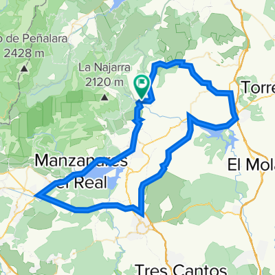
 Soto de Real - Morcuera - Lozoya - Canencia - Miraflores - Soto
- Distance
- 80.3 km
- Ascent
- 1,380 m
- Descent
- 1,380 m
- Location
- Miraflores de la Sierra, Madrid, Spain
 miraflores-la morcuera-canencia
- Distance
- 31.7 km
- Ascent
- 729 m
- Descent
- 729 m
- Location
- Miraflores de la Sierra, Madrid, Spain
 Miraflores-Atazar
- Distance
- 90.9 km
- Ascent
- 1,044 m
- Descent
- 1,045 m
- Location
- Miraflores de la Sierra, Madrid, Spain
 Miraflores-CerroSanPedro-Navalafuente-Bustarviejo-Miraflores
- Distance
- 86.9 km
- Ascent
- 769 m
- Descent
- 769 m
- Location
- Miraflores de la Sierra, Madrid, Spain
Open it in the app