

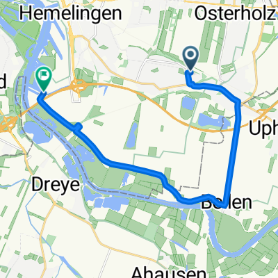
Hodenberger Deich - Hexenberg - Huxfeld - Wilstedt - Quelkhorn - Fischerhude - Klärwerk - Köbens - Bockhorster Mühlentor - Sagehorn - Lindenstraße - Breslauer S
A cycling route starting in Oyten, Lower Saxony, Germany.
Overview
About this route
Hodenberger Deich - Hexenberg - Huxfeld - Wilstedt - Quelkhorn - Fischerhude - Klärwerk - Köbens - Bockhorster Mühlentor - Sagehorn - Lindenstraße - Breslauer Straße - Stader Straße - Königsberger Straße - Meyerdamm - Hodenberger Deich
- -:--
- Duration
- 49 km
- Distance
- 73 m
- Ascent
- 71 m
- Descent
- ---
- Avg. speed
- ---
- Avg. speed
Route quality
Waytypes & surfaces along the route
Waytypes
Quiet road
21.5 km
(44 %)
Road
11.8 km
(24 %)
Surfaces
Paved
33.6 km
(69 %)
Asphalt
26.4 km
(54 %)
Paving stones
3.3 km
(7 %)
Continue with Bikemap
Use, edit, or download this cycling route
You would like to ride Hodenberger Deich - Hexenberg - Huxfeld - Wilstedt - Quelkhorn - Fischerhude - Klärwerk - Köbens - Bockhorster Mühlentor - Sagehorn - Lindenstraße - Breslauer S or customize it for your own trip? Here is what you can do with this Bikemap route:
Free features
- Save this route as favorite or in collections
- Copy & plan your own version of this route
- Sync your route with Garmin or Wahoo
Premium features
Free trial for 3 days, or one-time payment. More about Bikemap Premium.
- Navigate this route on iOS & Android
- Export a GPX / KML file of this route
- Create your custom printout (try it for free)
- Download this route for offline navigation
Discover more Premium features.
Get Bikemap PremiumFrom our community
Other popular routes starting in Oyten
 Tour Bremen-Uphusen-Oyten-Bremen
- Distance
- 19 km
- Ascent
- 7 m
- Descent
- 12 m
- Location
- Oyten, Lower Saxony, Germany
 Sonntags Radrunde durch und um Bremen
- Distance
- 48.9 km
- Ascent
- 33 m
- Descent
- 35 m
- Location
- Oyten, Lower Saxony, Germany
 Borsteler Straße 58, Oyten nach Beim Alten Hof 1, Wenzendorf
- Distance
- 70 km
- Ascent
- 608 m
- Descent
- 573 m
- Location
- Oyten, Lower Saxony, Germany
 Rund um die Borgfelder und Fischerhuder Wümmewiesen
- Distance
- 42.2 km
- Ascent
- 20 m
- Descent
- 21 m
- Location
- Oyten, Lower Saxony, Germany
 Lindenstraße 4, Oyten do Lindenstraße 4, Oyten
- Distance
- 13.4 km
- Ascent
- 24 m
- Descent
- 27 m
- Location
- Oyten, Lower Saxony, Germany
 Mountie-Grundstrecke-Tennispark
- Distance
- 17 km
- Ascent
- 50 m
- Descent
- 50 m
- Location
- Oyten, Lower Saxony, Germany
 Epp.-Bollen-Zum Schlut
- Distance
- 11.4 km
- Ascent
- 8 m
- Descent
- 8 m
- Location
- Oyten, Lower Saxony, Germany
 Epp.-Bollen-Achim-Uelsen-Grasdorf-Bassen-Sagehorn
- Distance
- 55.3 km
- Ascent
- 42 m
- Descent
- 45 m
- Location
- Oyten, Lower Saxony, Germany
Open it in the app