

Anschluss Mühlenweg Löbauer Wasser an Spreeradweg
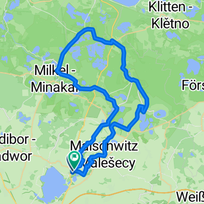
A cycling route starting in Malschwitz, Saxony, Germany.
Overview
About this route
halt nur ein Abschluss
- -:--
- Duration
- 8.7 km
- Distance
- 11 m
- Ascent
- 17 m
- Descent
- ---
- Avg. speed
- ---
- Avg. speed

Route quality
Waytypes & surfaces along the route
Waytypes
Quiet road
2.4 km
(28 %)
Track
1.9 km
(22 %)
Surfaces
Paved
3.4 km
(39 %)
Unpaved
4.7 km
(54 %)
Asphalt
3.4 km
(39 %)
Gravel
2.7 km
(31 %)
Continue with Bikemap
Use, edit, or download this cycling route
You would like to ride Anschluss Mühlenweg Löbauer Wasser an Spreeradweg or customize it for your own trip? Here is what you can do with this Bikemap route:
Free features
- Save this route as favorite or in collections
- Copy & plan your own version of this route
- Sync your route with Garmin or Wahoo
Premium features
Free trial for 3 days, or one-time payment. More about Bikemap Premium.
- Navigate this route on iOS & Android
- Export a GPX / KML file of this route
- Create your custom printout (try it for free)
- Download this route for offline navigation
Discover more Premium features.
Get Bikemap PremiumFrom our community
Other popular routes starting in Malschwitz
 Oberlausitzer Panoramatour 1.0
- Distance
- 62.3 km
- Ascent
- 346 m
- Descent
- 349 m
- Location
- Malschwitz, Saxony, Germany
 Bautzner Teiche 11.6.18
- Distance
- 35.3 km
- Ascent
- 71 m
- Descent
- 67 m
- Location
- Malschwitz, Saxony, Germany
 Kleiner Frosch
- Distance
- 44.3 km
- Ascent
- 83 m
- Descent
- 86 m
- Location
- Malschwitz, Saxony, Germany
 Teiche, Heide, Wälder und noch mehr Teiche; Variante II
- Distance
- 65.8 km
- Ascent
- 173 m
- Descent
- 176 m
- Location
- Malschwitz, Saxony, Germany
 RundumTour Malschwitz 2024
- Distance
- 43.5 km
- Ascent
- 133 m
- Descent
- 133 m
- Location
- Malschwitz, Saxony, Germany
 Bautzen rund um den See
- Distance
- 16 km
- Ascent
- 152 m
- Descent
- 157 m
- Location
- Malschwitz, Saxony, Germany
 Teiche, Wälder, Hügel …
- Distance
- 60.1 km
- Ascent
- 259 m
- Descent
- 262 m
- Location
- Malschwitz, Saxony, Germany
 Bärwalder See und Oberlausitzer Heide- und Teichlandschaft
- Distance
- 59.5 km
- Ascent
- 121 m
- Descent
- 124 m
- Location
- Malschwitz, Saxony, Germany