

bike tour from Curacaví to Pudahuel
A cycling route starting in Peñaflor, Santiago Metropolitan, Chile.
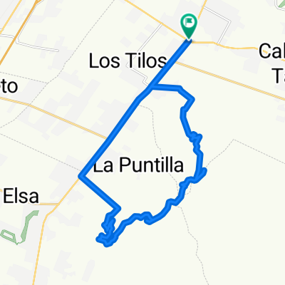
Overview
About this route
- -:--
- Duration
- 22 km
- Distance
- 624 m
- Ascent
- 358 m
- Descent
- ---
- Avg. speed
- ---
- Avg. speed

Continue with Bikemap
Use, edit, or download this cycling route
You would like to ride bike tour from Curacaví to Pudahuel or customize it for your own trip? Here is what you can do with this Bikemap route:
Free features
- Save this route as favorite or in collections
- Copy & plan your own version of this route
- Sync your route with Garmin or Wahoo
Premium features
Free trial for 3 days, or one-time payment. More about Bikemap Premium.
- Navigate this route on iOS & Android
- Export a GPX / KML file of this route
- Create your custom printout (try it for free)
- Download this route for offline navigation
Discover more Premium features.
Get Bikemap PremiumFrom our community
Other popular routes starting in Peñaflor
 San Pedro Fabro Norte, Padre Hurtado a Puerto Montt 18527, Maipú
- Distance
- 5.8 km
- Ascent
- 49 m
- Descent
- 3 m
- Location
- Peñaflor, Santiago Metropolitan, Chile
 De San José de Tango, Calera de Tango a Regidor Luis Alarcon C. 1309, Padre Hurtado
- Distance
- 9.7 km
- Ascent
- 33 m
- Descent
- 75 m
- Location
- Peñaflor, Santiago Metropolitan, Chile
 Ruta cuesta mallarauco
- Distance
- 17 km
- Ascent
- 541 m
- Descent
- 543 m
- Location
- Peñaflor, Santiago Metropolitan, Chile
 De Malloquito 2686, Penaflor a Santa Rosa 959, Penaflor
- Distance
- 34.4 km
- Ascent
- 60 m
- Descent
- 65 m
- Location
- Peñaflor, Santiago Metropolitan, Chile
 De Alcalde Luis Araya Cereceda 1046, Penaflor a Camino Mallarauco, Peñaflor
- Distance
- 5.1 km
- Ascent
- 8 m
- Descent
- 15 m
- Location
- Peñaflor, Santiago Metropolitan, Chile
 Ruta tranquila en Peñaflor
- Distance
- 12.1 km
- Ascent
- 240 m
- Descent
- 259 m
- Location
- Peñaflor, Santiago Metropolitan, Chile
 De Alcalde Luis Araya Cereceda 1046, Penaflor a Camino Mallarauco, Peñaflor
- Distance
- 7.8 km
- Ascent
- 48 m
- Descent
- 52 m
- Location
- Peñaflor, Santiago Metropolitan, Chile
 xc santuario de las aguilas
- Distance
- 23.1 km
- Ascent
- 593 m
- Descent
- 593 m
- Location
- Peñaflor, Santiago Metropolitan, Chile
Open it in the app