

MOTRIL-VELETA-MOTRIL. pto mas largo y alto Europa
A cycling route starting in El Varadero, Andalusia, Spain.
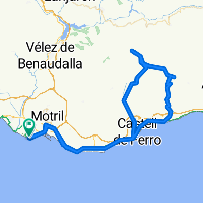
Overview
About this route
<span style="color: #000000; font-family: monospace; font-size: 13px; white-space: pre-wrap;">PUERTO MAS LARGO Y ALTO DE EUROPA: Salida desde Motril a nivel dle mar y finalizacion en Pico Veleta, Ctra mas alta de Europa. Por su extension es dificil definirlo asi, pero en realidad desde que se incia el recorrido en Motril la tendencia es a subir. LA mayor dificultad son los 50 km finales y sobre todo los 15 ultimos, a partir de Pradollano- Estacion ski, debido que a la pendiente tenemos que sumar la altitud, por encima ya de los 2.500m. Se finaliza a mas de 3200m de altitud. Para bajar de nuevopor detras en un descenso complicado...en sus kilometros iniciales. Al final se regresa por el mismo sitio, esta vez siempre con terreno a favor, y ¿viento???</span>
- -:--
- Duration
- 220.8 km
- Distance
- 3,906 m
- Ascent
- 3,907 m
- Descent
- ---
- Avg. speed
- ---
- Avg. speed

Continue with Bikemap
Use, edit, or download this cycling route
You would like to ride MOTRIL-VELETA-MOTRIL. pto mas largo y alto Europa or customize it for your own trip? Here is what you can do with this Bikemap route:
Free features
- Save this route as favorite or in collections
- Copy & plan your own version of this route
- Sync your route with Garmin or Wahoo
Premium features
Free trial for 3 days, or one-time payment. More about Bikemap Premium.
- Navigate this route on iOS & Android
- Export a GPX / KML file of this route
- Create your custom printout (try it for free)
- Download this route for offline navigation
Discover more Premium features.
Get Bikemap PremiumFrom our community
Other popular routes starting in El Varadero
 Bergfahrt 141km/2800Hm
- Distance
- 141.4 km
- Ascent
- 2,157 m
- Descent
- 2,159 m
- Location
- El Varadero, Andalusia, Spain
 El Varadero - Castell - Lujar - Motril
- Distance
- 95 km
- Ascent
- 1,578 m
- Descent
- 1,579 m
- Location
- El Varadero, Andalusia, Spain
 motril ,lqnjaron
- Distance
- 44 km
- Ascent
- 1,836 m
- Descent
- 1,189 m
- Location
- El Varadero, Andalusia, Spain
 Tag 11
- Distance
- 95.1 km
- Ascent
- 1,882 m
- Descent
- 1,882 m
- Location
- El Varadero, Andalusia, Spain
 Andalucia - 2012.08.12. Puerto Motril - Castell de Ferro - Rubite - Puerto Camacho (1125 m) - Haza de Lino (1280 m) - Castell de Ferro - Puerto Motril = 107,9 k
- Distance
- 103.7 km
- Ascent
- 1,857 m
- Descent
- 1,853 m
- Location
- El Varadero, Andalusia, Spain
 ESP 09: Motril - Alhambra/Granada - Motril
- Distance
- 149.2 km
- Ascent
- 1,425 m
- Descent
- 1,425 m
- Location
- El Varadero, Andalusia, Spain
 GR204 - Hermanamiento CostaBike - 15/02/09
- Distance
- 46.4 km
- Ascent
- 946 m
- Descent
- 945 m
- Location
- El Varadero, Andalusia, Spain
 motril- nerja
- Distance
- 46.2 km
- Ascent
- 647 m
- Descent
- 623 m
- Location
- El Varadero, Andalusia, Spain
Open it in the app