

Lindenberg 878
A cycling route starting in Muri, Canton of Aargau, Switzerland.
Overview
About this route
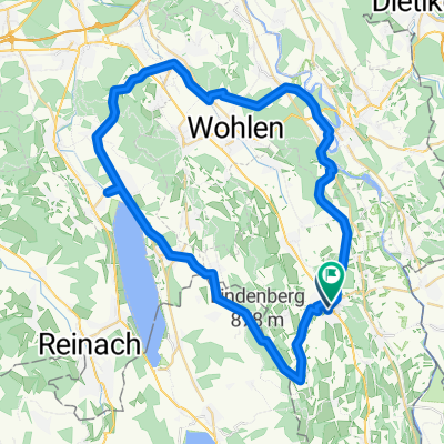
Höchster Punkt Lindenberg via Schweiel, Bbrunnwil, Horben zum Lindenberg. Rückweg via Guggibad, Wyssenbach Sagi und Langenmatt.
- -:--
- Duration
- 20 km
- Distance
- 475 m
- Ascent
- 473 m
- Descent
- ---
- Avg. speed
- ---
- Avg. speed

Route quality
Waytypes & surfaces along the route
Waytypes
Track
10 km
(50 %)
Quiet road
6.3 km
(31 %)
Surfaces
Paved
1.8 km
(9 %)
Unpaved
6.3 km
(32 %)
Gravel
4.5 km
(23 %)
Unpaved (undefined)
1.8 km
(9 %)
Continue with Bikemap
Use, edit, or download this cycling route
You would like to ride Lindenberg 878 or customize it for your own trip? Here is what you can do with this Bikemap route:
Free features
- Save this route as favorite or in collections
- Copy & plan your own version of this route
- Sync your route with Garmin or Wahoo
Premium features
Free trial for 3 days, or one-time payment. More about Bikemap Premium.
- Navigate this route on iOS & Android
- Export a GPX / KML file of this route
- Create your custom printout (try it for free)
- Download this route for offline navigation
Discover more Premium features.
Get Bikemap PremiumFrom our community
Other popular routes starting in Muri
 Muri-Sins
- Distance
- 31.2 km
- Ascent
- 162 m
- Descent
- 162 m
- Location
- Muri, Canton of Aargau, Switzerland
 Rundfahrt Muri - Lindenberg - Schloss Hallwil - Bremgarten- Muri
- Distance
- 52.1 km
- Ascent
- 624 m
- Descent
- 632 m
- Location
- Muri, Canton of Aargau, Switzerland
 Hausrunde Muri
- Distance
- 51.5 km
- Ascent
- 682 m
- Descent
- 626 m
- Location
- Muri, Canton of Aargau, Switzerland
 Muri-Frauental
- Distance
- 24.9 km
- Ascent
- 141 m
- Descent
- 141 m
- Location
- Muri, Canton of Aargau, Switzerland
 Muri-Lindenberg-Büttikon
- Distance
- 36.6 km
- Ascent
- 529 m
- Descent
- 529 m
- Location
- Muri, Canton of Aargau, Switzerland
 Muri - Ammerswil - Hallwil - Muri
- Distance
- 54.2 km
- Ascent
- 311 m
- Descent
- 311 m
- Location
- Muri, Canton of Aargau, Switzerland
 Freiamtweg Muri - Dietwil - Muri
- Distance
- 53.6 km
- Ascent
- 843 m
- Descent
- 632 m
- Location
- Muri, Canton of Aargau, Switzerland
 Route from 47.272548N, 8.341662E to Muri
- Distance
- 206.3 km
- Ascent
- 2,352 m
- Descent
- 2,355 m
- Location
- Muri, Canton of Aargau, Switzerland
Open it in the app