

Borsodi várak bringával 2016 6. Szerencs - Ónod
A cycling route starting in Szerencs, Borsod-Abauj Zemplen county, Hungary.
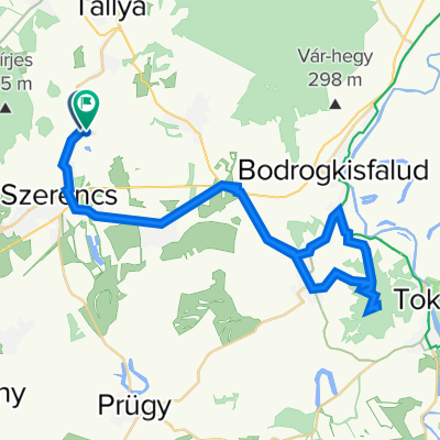
Overview
About this route
Szerencsi vár - Ónodi vár 39 Km szintemelkedés: 60m
- -:--
- Duration
- 39 km
- Distance
- 93 m
- Ascent
- 87 m
- Descent
- ---
- Avg. speed
- ---
- Avg. speed

Route quality
Waytypes & surfaces along the route
Waytypes
Busy road
28.7 km
(74 %)
Track
6.4 km
(17 %)
Surfaces
Paved
8.9 km
(23 %)
Unpaved
6.4 km
(17 %)
Asphalt
8.9 km
(23 %)
Ground
6.4 km
(17 %)
Undefined
23.7 km
(61 %)
Continue with Bikemap
Use, edit, or download this cycling route
You would like to ride Borsodi várak bringával 2016 6. Szerencs - Ónod or customize it for your own trip? Here is what you can do with this Bikemap route:
Free features
- Save this route as favorite or in collections
- Copy & plan your own version of this route
- Sync your route with Garmin or Wahoo
Premium features
Free trial for 3 days, or one-time payment. More about Bikemap Premium.
- Navigate this route on iOS & Android
- Export a GPX / KML file of this route
- Create your custom printout (try it for free)
- Download this route for offline navigation
Discover more Premium features.
Get Bikemap PremiumFrom our community
Other popular routes starting in Szerencs
 Ondi út 7., Szerencs to Ondi út 7., Szerencs
- Distance
- 27.1 km
- Ascent
- 260 m
- Descent
- 263 m
- Location
- Szerencs, Borsod-Abauj Zemplen county, Hungary
 Bringatúra 3. 2003
- Distance
- 395.8 km
- Ascent
- 214 m
- Descent
- 199 m
- Location
- Szerencs, Borsod-Abauj Zemplen county, Hungary
 Több napos vándor-túra a Feslő-Tisza mentén és a Bodrogközben
- Distance
- 346.1 km
- Ascent
- 217 m
- Descent
- 213 m
- Location
- Szerencs, Borsod-Abauj Zemplen county, Hungary
 Szerencs - Tállya - Monok kör
- Distance
- 28.5 km
- Ascent
- 421 m
- Descent
- 318 m
- Location
- Szerencs, Borsod-Abauj Zemplen county, Hungary
 Északi Határszél 1. nap
- Distance
- 56.4 km
- Ascent
- 380 m
- Descent
- 301 m
- Location
- Szerencs, Borsod-Abauj Zemplen county, Hungary
 szerencsi #3
- Distance
- 53.8 km
- Ascent
- 52 m
- Descent
- 52 m
- Location
- Szerencs, Borsod-Abauj Zemplen county, Hungary
 Tokaji hegy
- Distance
- 47.6 km
- Ascent
- 579 m
- Descent
- 588 m
- Location
- Szerencs, Borsod-Abauj Zemplen county, Hungary
 2017 / Dél-Zemplén
- Distance
- 115.5 km
- Ascent
- 612 m
- Descent
- 612 m
- Location
- Szerencs, Borsod-Abauj Zemplen county, Hungary
Open it in the app