

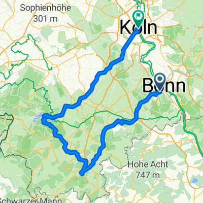
Bonn-Linz
A cycling route starting in Bonn, North Rhine-Westphalia, Germany.
Overview
About this route
Sehr flach. In Linz nimmt man die Fähre. Unterwegs lohnt sich durch Erpel statt direkt am Rhein zu fahren. Schöne kleine Stadt mit historischen Stadkern. Die Brücke von Remagen - Museum. Linz ist auch ein Besuch wert. Remagen: ein schöner Stop und eine Mittagspause. Rückfahrt am Rhein, Rheinaue.
- -:--
- Duration
- 56.8 km
- Distance
- 128 m
- Ascent
- 130 m
- Descent
- ---
- Avg. speed
- ---
- Avg. speed

Route quality
Waytypes & surfaces along the route
Waytypes
Path
20.3 km
(36 %)
Quiet road
9.5 km
(17 %)
Surfaces
Paved
53.1 km
(93 %)
Unpaved
1.5 km
(3 %)
Asphalt
38.4 km
(68 %)
Paving stones
11.9 km
(21 %)
Continue with Bikemap
Use, edit, or download this cycling route
You would like to ride Bonn-Linz or customize it for your own trip? Here is what you can do with this Bikemap route:
Free features
- Save this route as favorite or in collections
- Copy & plan your own version of this route
- Sync your route with Garmin or Wahoo
Premium features
Free trial for 3 days, or one-time payment. More about Bikemap Premium.
- Navigate this route on iOS & Android
- Export a GPX / KML file of this route
- Create your custom printout (try it for free)
- Download this route for offline navigation
Discover more Premium features.
Get Bikemap PremiumFrom our community
Other popular routes starting in Bonn
 BRT2016-FR: An Rhein und Sieg - RTF des Radsportbezirk Mittelrhein-Süd beim BRT 2016 in Bonn - 105 km Strecke einer Pfeil-Such-Fahrt
- Distance
- 104.9 km
- Ascent
- 1,022 m
- Descent
- 1,023 m
- Location
- Bonn, North Rhine-Westphalia, Germany
 Lockere 1Stunde rund und in Beuel
- Distance
- 21.3 km
- Ascent
- 182 m
- Descent
- 168 m
- Location
- Bonn, North Rhine-Westphalia, Germany
 BRT2016-FR: An Rhein und Sieg - PSF des Radsportbezirk Mittelrhein-Süd beim BRT 2016 in Bonn - 76 km Strecke
- Distance
- 74.9 km
- Ascent
- 509 m
- Descent
- 509 m
- Location
- Bonn, North Rhine-Westphalia, Germany
 Bonn - Stadt Blankenberg
- Distance
- 79.5 km
- Ascent
- 846 m
- Descent
- 846 m
- Location
- Bonn, North Rhine-Westphalia, Germany
 T-Mobile-Rheinauen-Mehlem-Köwi-Dollendorf-Rheinauen-T-Mobile
- Distance
- 15.6 km
- Ascent
- 50 m
- Descent
- 50 m
- Location
- Bonn, North Rhine-Westphalia, Germany
 kleine McDrive-Runde (Ittenbach)
- Distance
- 40.7 km
- Ascent
- 437 m
- Descent
- 437 m
- Location
- Bonn, North Rhine-Westphalia, Germany
 Bonn - Eifel - Westerwald - Bonn
- Distance
- 189.7 km
- Ascent
- 1,343 m
- Descent
- 1,341 m
- Location
- Bonn, North Rhine-Westphalia, Germany
 Bonn - Ahrquelle - Rursee - Köln
- Distance
- 154 km
- Ascent
- 987 m
- Descent
- 1,006 m
- Location
- Bonn, North Rhine-Westphalia, Germany
Open it in the app