

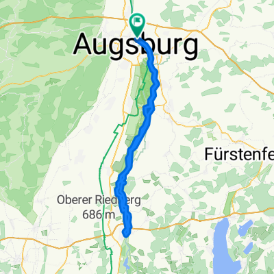
Augsburg-Lechquelle-Reutte 300km
A cycling route starting in Augsburg, Bavaria, Germany.
Overview
About this route
Augsburg-Lechquelle-Reutte 300km
- -:--
- Duration
- 299.2 km
- Distance
- 1,408 m
- Ascent
- 1,031 m
- Descent
- ---
- Avg. speed
- ---
- Avg. speed
Route quality
Waytypes & surfaces along the route
Waytypes
Track
101.7 km
(34 %)
Quiet road
70 km
(23 %)
Surfaces
Paved
229.5 km
(77 %)
Unpaved
47.7 km
(16 %)
Asphalt
215.3 km
(72 %)
Gravel
20.6 km
(7 %)
Continue with Bikemap
Use, edit, or download this cycling route
You would like to ride Augsburg-Lechquelle-Reutte 300km or customize it for your own trip? Here is what you can do with this Bikemap route:
Free features
- Save this route as favorite or in collections
- Copy & plan your own version of this route
- Sync your route with Garmin or Wahoo
Premium features
Free trial for 3 days, or one-time payment. More about Bikemap Premium.
- Navigate this route on iOS & Android
- Export a GPX / KML file of this route
- Create your custom printout (try it for free)
- Download this route for offline navigation
Discover more Premium features.
Get Bikemap PremiumFrom our community
Other popular routes starting in Augsburg
 Augsburg-Füssen
- Distance
- 117.2 km
- Ascent
- 713 m
- Descent
- 414 m
- Location
- Augsburg, Bavaria, Germany
 Augsburg-Landsberg-Augsburg
- Distance
- 90.4 km
- Ascent
- 195 m
- Descent
- 194 m
- Location
- Augsburg, Bavaria, Germany
 Wertach ab Thelottviertel bis Stausee
- Distance
- 24.8 km
- Ascent
- 137 m
- Descent
- 136 m
- Location
- Augsburg, Bavaria, Germany
 Via Claudia NEIL
- Distance
- 577.1 km
- Ascent
- 2,055 m
- Descent
- 2,544 m
- Location
- Augsburg, Bavaria, Germany
 Augsburgerrunde
- Distance
- 69.9 km
- Ascent
- 344 m
- Descent
- 343 m
- Location
- Augsburg, Bavaria, Germany
 Idyllisches Anhauser Tal – Bismarckturm Neusäß Runde von Augsburg Hauptbahnhof - Idyllisches Anhauser Tal – Bismarckturm Neusäß Runde von Augsburg Hauptbahnhof
- Distance
- 63.3 km
- Ascent
- 339 m
- Descent
- 337 m
- Location
- Augsburg, Bavaria, Germany
 Weldenrundfahrt
- Distance
- 78.6 km
- Ascent
- 481 m
- Descent
- 503 m
- Location
- Augsburg, Bavaria, Germany
 Augsburg - Westliche Wälder und zurück
- Distance
- 31.3 km
- Ascent
- 444 m
- Descent
- 467 m
- Location
- Augsburg, Bavaria, Germany
Open it in the app