

Mont du Chat, Grand Colombier, Semnoz, Revard
A cycling route starting in Drumettaz-Clarafond, Auvergne-Rhône-Alpes, France.
Overview
About this route
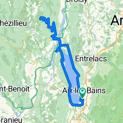
Mont du Chat, Grand Colombier, Semnoz, Revard
- -:--
- Duration
- 222.4 km
- Distance
- 5,238 m
- Ascent
- 5,238 m
- Descent
- ---
- Avg. speed
- ---
- Avg. speed
Route quality
Waytypes & surfaces along the route
Waytypes
Road
102.6 km
(46 %)
Busy road
96.2 km
(43 %)
Surfaces
Paved
155 km
(70 %)
Unpaved
2 km
(<1 %)
Asphalt
154.6 km
(70 %)
Ground
1.4 km
(<1 %)
Continue with Bikemap
Use, edit, or download this cycling route
You would like to ride Mont du Chat, Grand Colombier, Semnoz, Revard or customize it for your own trip? Here is what you can do with this Bikemap route:
Free features
- Save this route as favorite or in collections
- Copy & plan your own version of this route
- Sync your route with Garmin or Wahoo
Premium features
Free trial for 3 days, or one-time payment. More about Bikemap Premium.
- Navigate this route on iOS & Android
- Export a GPX / KML file of this route
- Create your custom printout (try it for free)
- Download this route for offline navigation
Discover more Premium features.
Get Bikemap PremiumFrom our community
Other popular routes starting in Drumettaz-Clarafond
 2012-9: Aix-les-Bains > St-Jean-de-Maurienne (170,5 km)
- Distance
- 170.3 km
- Ascent
- 2,980 m
- Descent
- 2,699 m
- Location
- Drumettaz-Clarafond, Auvergne-Rhône-Alpes, France
 Mont du Chat, Grand Colombier, Semnoz, Revard
- Distance
- 222.4 km
- Ascent
- 5,238 m
- Descent
- 5,238 m
- Location
- Drumettaz-Clarafond, Auvergne-Rhône-Alpes, France
 Randonnée Drumettaz Clarafond
- Distance
- 6 km
- Ascent
- 322 m
- Descent
- 263 m
- Location
- Drumettaz-Clarafond, Auvergne-Rhône-Alpes, France
 De Chemin de l'Arête 350, Drumettaz-Clarafond à Route du Chef- Lieu 371, Drumettaz-Clarafond
- Distance
- 8.7 km
- Ascent
- 688 m
- Descent
- 692 m
- Location
- Drumettaz-Clarafond, Auvergne-Rhône-Alpes, France
 2e Dag Aix-les-Bains
- Distance
- 93.5 km
- Ascent
- 1,890 m
- Descent
- 1,892 m
- Location
- Drumettaz-Clarafond, Auvergne-Rhône-Alpes, France
 2e Dag Aix-les-Bains
- Distance
- 94.1 km
- Ascent
- 1,906 m
- Descent
- 1,908 m
- Location
- Drumettaz-Clarafond, Auvergne-Rhône-Alpes, France
 Two titi race 121
- Distance
- 121.7 km
- Ascent
- 2,725 m
- Descent
- 2,725 m
- Location
- Drumettaz-Clarafond, Auvergne-Rhône-Alpes, France
 2e Dag Aix-les-Bains
- Distance
- 94.2 km
- Ascent
- 1,893 m
- Descent
- 1,895 m
- Location
- Drumettaz-Clarafond, Auvergne-Rhône-Alpes, France
Open it in the app