Premium Badge Download on the App Store Get it on Google Play Turn-by-turn Navigation Offline Maps Bike Type Optimized Routing Premium Maps Custom Bike Computer Export Routes Route Previews Fall Detection Premium Support

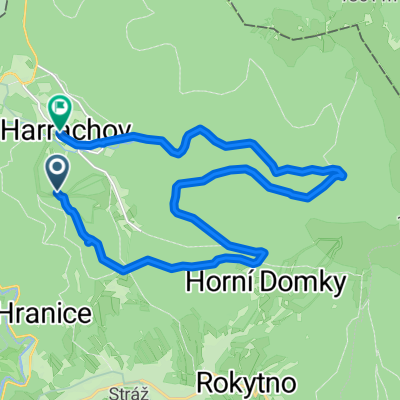
Cycling Route in Harrachov, Liberecký kraj, Czechia

Harrachov

0
Open this route in the Bikemap app

Open this route in the Bikemap app

Open this route in Bikemap Web

Open this route in Bikemap Web

29 km
Distance
637 m
Ascent
957 m
Descent
-:-- h
Duration
-- km/h
Avg. Speed
--- m
Max. Elevation

About This Route

Harrachov - Čertova Hora, Studenov, Lysá hora, Růženčina zahrádka, Zlaté Návrší, Pramen Labe, Violík, Sněžné Jámy (PL), Česká budka, Svinské Kameny, Pod Voseckou boudou, Krakonošova snídaně, Harrachov

This cycling route is ideal for: MTB

You will cycle on the following surfaces: Paved

Customize this cycling route with the Bikemap route planner.

Make it yours!

Did you know? You can use this route as a template in our cycling route planner if you don't wish to start from scratch. Customize it based on your needs to plan your perfect cycling tour.

Open it in the app