
Rudolst-Uhlstädter-Heide
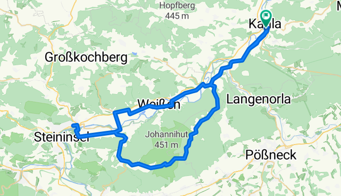
A cycling route starting in Kahla, Free State of Thuringia, Germany.
Overview
About this route
Kahla
Uhlstädter-Heide
Rudolstadt
Kahla
- -:--
- Duration
- 59.6 km
- Distance
- 473 m
- Ascent
- 483 m
- Descent
- ---
- Avg. speed
- ---
- Avg. speed

Route quality
Waytypes & surfaces along the route
Waytypes
Quiet road
20.2 km
(34 %)
Road
10.8 km
(18 %)
Surfaces
Paved
37.8 km
(63 %)
Unpaved
0 km
(<1 %)
Asphalt
36.4 km
(61 %)
Concrete
0.9 km
(1 %)
Continue with Bikemap
Use, edit, or download this cycling route
You would like to ride Rudolst-Uhlstädter-Heide or customize it for your own trip? Here is what you can do with this Bikemap route:
Free features
- Save this route as favorite or in collections
- Copy & plan your own version of this route
- Sync your route with Garmin or Wahoo
Premium features
Free trial for 3 days, or one-time payment. More about Bikemap Premium.
- Navigate this route on iOS & Android
- Export a GPX / KML file of this route
- Create your custom printout (try it for free)
- Download this route for offline navigation
Discover more Premium features.
Get Bikemap PremiumFrom our community
Other popular routes starting in Kahla
 Kahla-LB-Bergwertung
- Distance
- 2.5 km
- Ascent
- 312 m
- Descent
- 121 m
- Location
- Kahla, Free State of Thuringia, Germany
 Männertag 2011 Schlauchboot
- Distance
- 20.2 km
- Ascent
- 79 m
- Descent
- 100 m
- Location
- Kahla, Free State of Thuringia, Germany
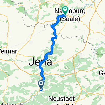
 Saale 4 (Kahla-Jena-Ilmmündung-Apolda) Ilm 3
- Distance
- 74.2 km
- Ascent
- 225 m
- Descent
- 229 m
- Location
- Kahla, Free State of Thuringia, Germany
 RFVA-Herrentour 2009 Tag 3 - 5
- Distance
- 72 km
- Ascent
- 71 m
- Descent
- 119 m
- Location
- Kahla, Free State of Thuringia, Germany
 Saale 3, Kahla-Naumburg
- Distance
- 63.4 km
- Ascent
- 202 m
- Descent
- 259 m
- Location
- Kahla, Free State of Thuringia, Germany
 L1062 28, Kahla nach Roßstraße 35, Kahla
- Distance
- 57.8 km
- Ascent
- 739 m
- Descent
- 742 m
- Location
- Kahla, Free State of Thuringia, Germany
 Saale 8: Kahla - Schönburg Alter Felsenkeller, 70,6km, 194hm
- Distance
- 71.7 km
- Ascent
- 194 m
- Descent
- 261 m
- Location
- Kahla, Free State of Thuringia, Germany
 20. Radwanderung Sparkasse Jena und Barmer 04.11.2011
- Distance
- 91.4 km
- Ascent
- 488 m
- Descent
- 487 m
- Location
- Kahla, Free State of Thuringia, Germany
Open it in the app