

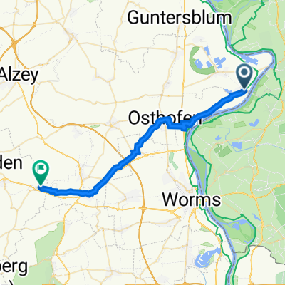
Ludwigshafen a.Rhein - Worms Hamm
A cycling route starting in Eich, Rhineland-Palatinate, Germany.
Overview
About this route
- -:--
- Duration
- 36.9 km
- Distance
- 43 m
- Ascent
- 41 m
- Descent
- ---
- Avg. speed
- ---
- Avg. speed
Route quality
Waytypes & surfaces along the route
Waytypes
Track
12.8 km
(35 %)
Path
9 km
(24 %)
Surfaces
Paved
35.4 km
(96 %)
Unpaved
0.5 km
(1 %)
Asphalt
33 km
(89 %)
Paving stones
1.9 km
(5 %)
Continue with Bikemap
Use, edit, or download this cycling route
You would like to ride Ludwigshafen a.Rhein - Worms Hamm or customize it for your own trip? Here is what you can do with this Bikemap route:
Free features
- Save this route as favorite or in collections
- Copy & plan your own version of this route
- Sync your route with Garmin or Wahoo
Premium features
Free trial for 3 days, or one-time payment. More about Bikemap Premium.
- Navigate this route on iOS & Android
- Export a GPX / KML file of this route
- Create your custom printout (try it for free)
- Download this route for offline navigation
Discover more Premium features.
Get Bikemap PremiumFrom our community
Other popular routes starting in Eich
 Eich-Osthofen-Bechtheim-Dittelsheim-Heßloch-Monzernheim 36 km
- Distance
- 36.1 km
- Ascent
- 189 m
- Descent
- 190 m
- Location
- Eich, Rhineland-Palatinate, Germany
 Eich-Ruppertsberg-Rockenhausen-Falkenstein-Donnersberg-Zellertal-Eich 127 km
- Distance
- 127.3 km
- Ascent
- 1,202 m
- Descent
- 1,204 m
- Location
- Eich, Rhineland-Palatinate, Germany
 Rheinhessen-Odenwald 105 km
- Distance
- 105.7 km
- Ascent
- 609 m
- Descent
- 607 m
- Location
- Eich, Rhineland-Palatinate, Germany
 Eich-Nierstein-Odenwald-Worms 138 km
- Distance
- 138.3 km
- Ascent
- 583 m
- Descent
- 585 m
- Location
- Eich, Rhineland-Palatinate, Germany
 Eich-Nierstein-Odenwald-Gernsheim-Eich 140 km
- Distance
- 140.7 km
- Ascent
- 682 m
- Descent
- 681 m
- Location
- Eich, Rhineland-Palatinate, Germany
 Eich-Mainz-Worms-Eich 120 km
- Distance
- 119.9 km
- Ascent
- 243 m
- Descent
- 243 m
- Location
- Eich, Rhineland-Palatinate, Germany
 Hamm am Rhein nach Zellertal
- Distance
- 28.5 km
- Ascent
- 325 m
- Descent
- 253 m
- Location
- Eich, Rhineland-Palatinate, Germany
 Rheinhessen 50 km
- Distance
- 49.6 km
- Ascent
- 37 m
- Descent
- 37 m
- Location
- Eich, Rhineland-Palatinate, Germany
Open it in the app