

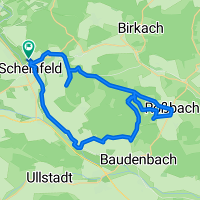
Bad Windsheim
A cycling route starting in Scheinfeld, Bavaria, Germany.
Overview
About this route
- -:--
- Duration
- 67.1 km
- Distance
- 185 m
- Ascent
- 190 m
- Descent
- ---
- Avg. speed
- ---
- Avg. speed
Route quality
Waytypes & surfaces along the route
Waytypes
Quiet road
22.5 km
(34 %)
Track
16.7 km
(25 %)
Surfaces
Paved
38.3 km
(57 %)
Unpaved
0.3 km
(<1 %)
Asphalt
29.4 km
(44 %)
Concrete
6.5 km
(10 %)
Continue with Bikemap
Use, edit, or download this cycling route
You would like to ride Bad Windsheim or customize it for your own trip? Here is what you can do with this Bikemap route:
Free features
- Save this route as favorite or in collections
- Copy & plan your own version of this route
- Sync your route with Garmin or Wahoo
Premium features
Free trial for 3 days, or one-time payment. More about Bikemap Premium.
- Navigate this route on iOS & Android
- Export a GPX / KML file of this route
- Create your custom printout (try it for free)
- Download this route for offline navigation
Discover more Premium features.
Get Bikemap PremiumFrom our community
Other popular routes starting in Scheinfeld
 Grappertshofen Castell Neubauhof
- Distance
- 40.7 km
- Ascent
- 498 m
- Descent
- 498 m
- Location
- Scheinfeld, Bavaria, Germany
 Bad Windsheim
- Distance
- 67.1 km
- Ascent
- 185 m
- Descent
- 190 m
- Location
- Scheinfeld, Bavaria, Germany
 Trail Burgruine Scharfeneck
- Distance
- 25.2 km
- Ascent
- 378 m
- Descent
- 377 m
- Location
- Scheinfeld, Bavaria, Germany
 Badstraße 5, Scheinfeld nach Steigerwald Straße 23, Markt Taschendorf
- Distance
- 12.4 km
- Ascent
- 202 m
- Descent
- 174 m
- Location
- Scheinfeld, Bavaria, Germany
 SEF - Ebrach
- Distance
- 74.9 km
- Ascent
- 1,148 m
- Descent
- 1,147 m
- Location
- Scheinfeld, Bavaria, Germany
 Durch den hügeligen Steigerwald
- Distance
- 40.2 km
- Ascent
- 459 m
- Descent
- 407 m
- Location
- Scheinfeld, Bavaria, Germany
 Gesundheitsquelle Baudenbach
- Distance
- 27.9 km
- Ascent
- 311 m
- Descent
- 309 m
- Location
- Scheinfeld, Bavaria, Germany
 Fahrt von SEF zur Burg Hoheneck auf Wanderwegen
- Distance
- 58.4 km
- Ascent
- 580 m
- Descent
- 581 m
- Location
- Scheinfeld, Bavaria, Germany
Open it in the app