

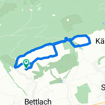
Ausfahrt vom 09.09.16 19:53
A cycling route starting in Bettlach, Canton of Solothurn, Switzerland.
Overview
About this route
- -:--
- Duration
- 20.4 km
- Distance
- 671 m
- Ascent
- 671 m
- Descent
- ---
- Avg. speed
- ---
- Avg. speed

Route quality
Waytypes & surfaces along the route
Waytypes
Track
8.1 km
(40 %)
Road
7.1 km
(35 %)
Surfaces
Paved
6.6 km
(32 %)
Unpaved
7.4 km
(36 %)
Asphalt
6.2 km
(31 %)
Gravel
5.4 km
(26 %)
Route highlights
Points of interest along the route

Point of interest after 8.7 km
grenchenberg

Point of interest after 10.7 km
umkrhr
Continue with Bikemap
Use, edit, or download this cycling route
You would like to ride Ausfahrt vom 09.09.16 19:53 or customize it for your own trip? Here is what you can do with this Bikemap route:
Free features
- Save this route as favorite or in collections
- Copy & plan your own version of this route
- Sync your route with Garmin or Wahoo
Premium features
Free trial for 3 days, or one-time payment. More about Bikemap Premium.
- Navigate this route on iOS & Android
- Export a GPX / KML file of this route
- Create your custom printout (try it for free)
- Download this route for offline navigation
Discover more Premium features.
Get Bikemap PremiumFrom our community
Other popular routes starting in Bettlach
 2.2.Tour La Huette über Jobert, Walberg nach Gleresse
- Distance
- 38.1 km
- Ascent
- 1,024 m
- Descent
- 1,137 m
- Location
- Bettlach, Canton of Solothurn, Switzerland
 Lange Radrunde vom 10.08.16 17:58
- Distance
- 60.9 km
- Ascent
- 109 m
- Descent
- 312 m
- Location
- Bettlach, Canton of Solothurn, Switzerland
 Bettle - Böz
- Distance
- 37.4 km
- Ascent
- 1,167 m
- Descent
- 1,186 m
- Location
- Bettlach, Canton of Solothurn, Switzerland
 Ausfahrt vom 09.09.16 19:53
- Distance
- 20.4 km
- Ascent
- 671 m
- Descent
- 671 m
- Location
- Bettlach, Canton of Solothurn, Switzerland
 Kurze Ausfahrt vom 22.07.16 19:23
- Distance
- 6.5 km
- Ascent
- 149 m
- Descent
- 148 m
- Location
- Bettlach, Canton of Solothurn, Switzerland
 Bucheggberg Route
- Distance
- 115.9 km
- Ascent
- 795 m
- Descent
- 833 m
- Location
- Bettlach, Canton of Solothurn, Switzerland
 Grenchenberg
- Distance
- 13.7 km
- Ascent
- 845 m
- Descent
- 15 m
- Location
- Bettlach, Canton of Solothurn, Switzerland
 Bucheggberg Route
- Distance
- 115.8 km
- Ascent
- 798 m
- Descent
- 836 m
- Location
- Bettlach, Canton of Solothurn, Switzerland
Open it in the app