

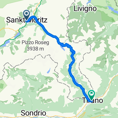
St. Moritz - Scuol
A cycling route starting in St. Moritz, Grisons, Switzerland.
Overview
About this route
Nach dem Ruhetag freue ich mich auf die Weiterreise, vor allem weil es ab hier nunmehr nur noch bergab geht.
Vorbei am St Moritz See führt der Radweg nach Samedan. In Zernez raste ich, bevor es dann doch noch einmal kräftig bergauf geht. Der Abstecher hinauf nach Guarda ist aber durchaus lohnend, das kleine Dörfchen hat seinen Charme. Es wartet nun eine rasante Abfahrt hinunter ins Inntal. So ist mein Tagesziel Scoul schnell erreicht. Ich quartiere mich auf dem Campingplatz ein und entspanne mich im hiesigen Thermalbad. Am Abend gibt's dann doch noch einen Regenschauer, der aber in der Nacht abklingt.
- -:--
- Duration
- 70.5 km
- Distance
- 474 m
- Ascent
- 1,045 m
- Descent
- ---
- Avg. speed
- ---
- Avg. speed

Route quality
Waytypes & surfaces along the route
Waytypes
Track
25.7 km
(36 %)
Quiet road
15.7 km
(22 %)
Surfaces
Paved
36.8 km
(52 %)
Unpaved
18 km
(25 %)
Asphalt
32.8 km
(46 %)
Gravel
10.8 km
(15 %)
Continue with Bikemap
Use, edit, or download this cycling route
You would like to ride St. Moritz - Scuol or customize it for your own trip? Here is what you can do with this Bikemap route:
Free features
- Save this route as favorite or in collections
- Copy & plan your own version of this route
- Sync your route with Garmin or Wahoo
Premium features
Free trial for 3 days, or one-time payment. More about Bikemap Premium.
- Navigate this route on iOS & Android
- Export a GPX / KML file of this route
- Create your custom printout (try it for free)
- Download this route for offline navigation
Discover more Premium features.
Get Bikemap PremiumFrom our community
Other popular routes starting in St. Moritz
 Girolibero: St. Moritz Innsbruck
- Distance
- 143.2 km
- Ascent
- 267 m
- Descent
- 1,292 m
- Location
- St. Moritz, Grisons, Switzerland
 Sankt Moritz bis Genua
- Distance
- 446.4 km
- Ascent
- 13,476 m
- Descent
- 15,256 m
- Location
- St. Moritz, Grisons, Switzerland
 Alpi 2008 - Etapa 4 - Sankt Moritz - Tirano
- Distance
- 56.5 km
- Ascent
- 859 m
- Descent
- 2,086 m
- Location
- St. Moritz, Grisons, Switzerland
 Inntour von ST. Moritz nach Passau
- Distance
- 504.9 km
- Ascent
- 366 m
- Descent
- 1,845 m
- Location
- St. Moritz, Grisons, Switzerland
 st.moritz-innsbruck-passau
- Distance
- 571.7 km
- Ascent
- 226 m
- Descent
- 1,732 m
- Location
- St. Moritz, Grisons, Switzerland
 Piz Nair - Trais Fluors - Samedan - St. Moritz
- Distance
- 21.9 km
- Ascent
- 414 m
- Descent
- 1,660 m
- Location
- St. Moritz, Grisons, Switzerland
 20150727_INN00 Skt. Moritz - Malojapass - Skt. Moritz
- Distance
- 39.1 km
- Ascent
- 203 m
- Descent
- 187 m
- Location
- St. Moritz, Grisons, Switzerland
 Suvrettapass
- Distance
- 23.8 km
- Ascent
- 548 m
- Descent
- 1,085 m
- Location
- St. Moritz, Grisons, Switzerland