

Three Alpine Peaks - Big Day out!
A cycling route starting in Morzine, Auvergne-Rhône-Alpes, France.
Overview
About this route
This Alpine three peak classic will see you start after breakfsat on the Col de la Joue Verte, climbing through the hairpins where myrtille bushes can provide a nice pause for some natural and hand-picked energy before descending into Morzine above the canopies of the many paragliders that colour the morning horizon. In Morzine, you will then tackle the famous Col de la Joue Plane wich rises to spectactular views over the Alps before sweeping into the heart of the beautiful village of Samoëns. You can call it a day here and hop into our van for the trip home, or if your feeling good, you can practice your drafting technique along the flat as a pancake vally floor to Tanninges and then Mieussy from where you can join the ranks of the legends of the Tour de France on the Col de la Ramaz along to the Col villages of Encrenaz and the Côte d'Arbroz. Finally decend once again into Morzine after a day well cycled and cool down on the final gentle ascent to the village - Or order a beer and call us to collect you!
- -:--
- Duration
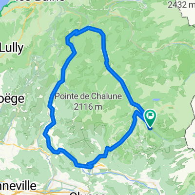
- 97 km
- Distance
- 2,781 m
- Ascent
- 2,788 m
- Descent
- ---
- Avg. speed
- ---
- Avg. speed

Route quality
Waytypes & surfaces along the route
Waytypes
Road
58 km
(60 %)
Busy road
20.5 km
(21 %)
Surfaces
Paved
72.2 km
(74 %)
Unpaved
3.9 km
(4 %)
Asphalt
70.1 km
(72 %)
Gravel
2.6 km
(3 %)
Continue with Bikemap
Use, edit, or download this cycling route
You would like to ride Three Alpine Peaks - Big Day out! or customize it for your own trip? Here is what you can do with this Bikemap route:
Free features
- Save this route as favorite or in collections
- Copy & plan your own version of this route
- Sync your route with Garmin or Wahoo
Premium features
Free trial for 3 days, or one-time payment. More about Bikemap Premium.
- Navigate this route on iOS & Android
- Export a GPX / KML file of this route
- Create your custom printout (try it for free)
- Download this route for offline navigation
Discover more Premium features.
Get Bikemap PremiumFrom our community
Other popular routes starting in Morzine
 Morzine - Col de la Ramaz - Col de la Colombière
- Distance
- 133.7 km
- Ascent
- 2,660 m
- Descent
- 2,654 m
- Location
- Morzine, Auvergne-Rhône-Alpes, France
 Joux Verte-Joux Plane-Ramaz-Encrenaz
- Distance
- 106.8 km
- Ascent
- 3,605 m
- Descent
- 3,602 m
- Location
- Morzine, Auvergne-Rhône-Alpes, France
 gets rondje
- Distance
- 44.5 km
- Ascent
- 1,626 m
- Descent
- 1,574 m
- Location
- Morzine, Auvergne-Rhône-Alpes, France
 Morzine Sportive - Short Version
- Distance
- 103.6 km
- Ascent
- 1,763 m
- Descent
- 1,761 m
- Location
- Morzine, Auvergne-Rhône-Alpes, France
 Tour du Roc d'Enfer
- Distance
- 78.9 km
- Ascent
- 1,128 m
- Descent
- 1,121 m
- Location
- Morzine, Auvergne-Rhône-Alpes, France
 Morzine-Avoriaz
- Distance
- 29.2 km
- Ascent
- 922 m
- Descent
- 906 m
- Location
- Morzine, Auvergne-Rhône-Alpes, France
 Tour d'Enfer : Day 1 - Morzine to La Clusaz
- Distance
- 75.7 km
- Ascent
- 1,814 m
- Descent
- 1,629 m
- Location
- Morzine, Auvergne-Rhône-Alpes, France
 Alps Three Peaks Challenge Col de Joux Verte, Col de Jeu Plane, Col de l'Encrenaz
- Distance
- 76 km
- Ascent
- 2,340 m
- Descent
- 2,347 m
- Location
- Morzine, Auvergne-Rhône-Alpes, France
Open it in the app