

Elsener Seentour - Gemütlich und landschaftlich reizvoll auch für Kinder
A cycling route starting in Paderborn, North Rhine-Westphalia, Germany.
Overview
About this route
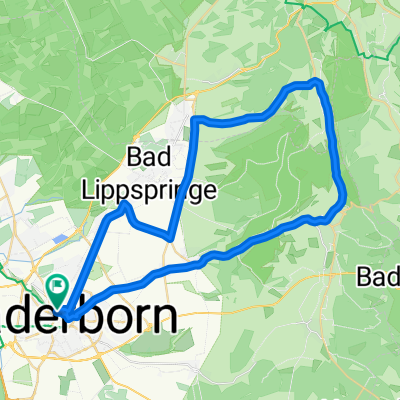
Start und Ziel: ALDI-Parkplatz, Wewerstr. 27, 33106 Paderborn Position: 51° 43' 47.3" N - 8° 41' 32.7" O
Länge: 16,86 km, Höhendifferenz: 122 m, max. Steigung: 4,9-5,5%, durchschnttl. Steigung 1,5%.
Überwiegend sehr ruhige Feldwege, reine Rad- und Fußwege und eigene Radwege neben Autostrassen - wo es nur ging. Insofern auch weitestgehend für Ausflüge mit Kindern ab 8 Jahren unter Begleitung geeignet. Gesamtstrecke: 16,9 km und 20 hm. Keine drastischen Steigungen. Batteriefahrrad unnötig.
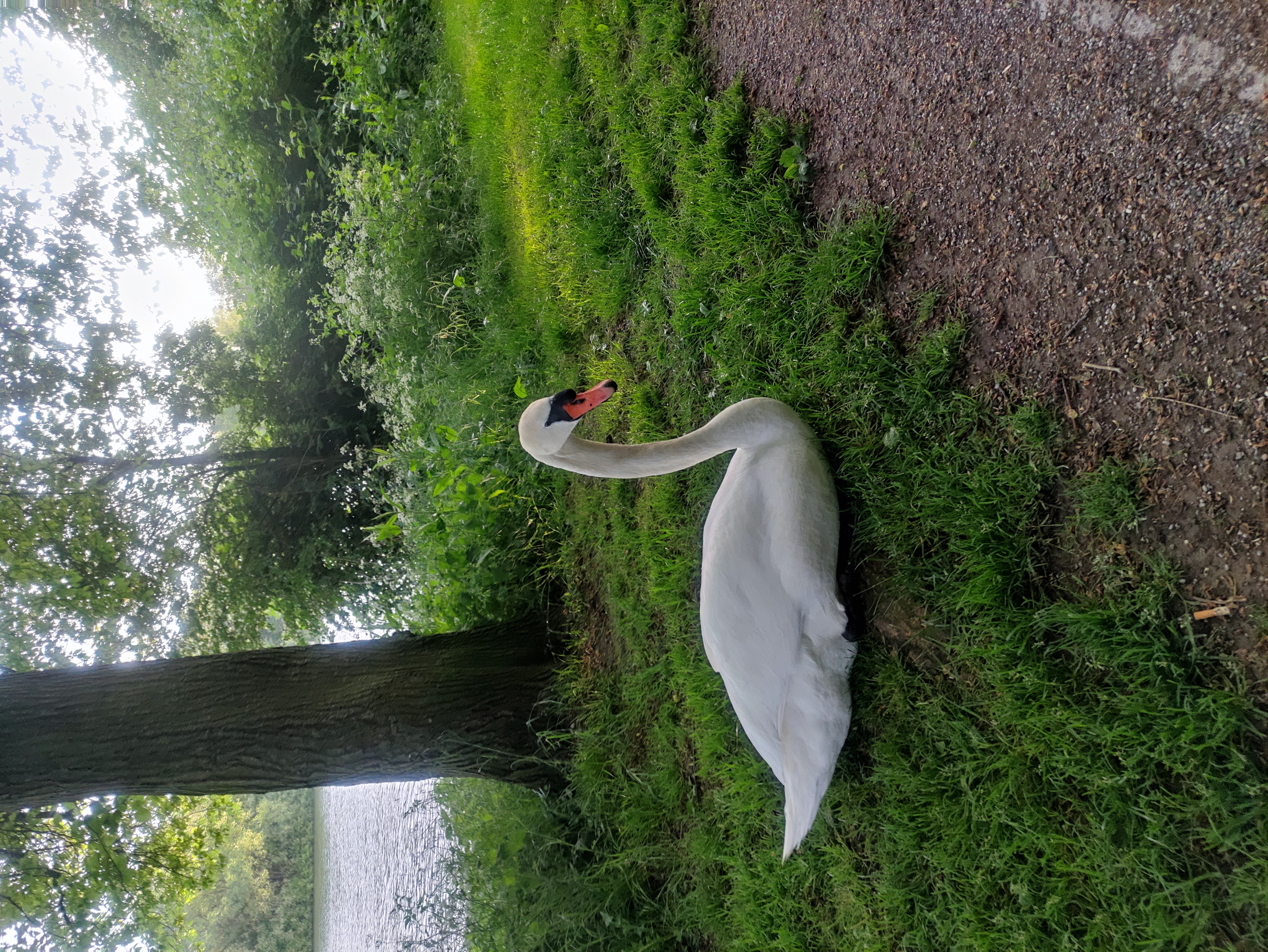
Es finden sich immer wieder schöne Rastplätze längs der Wege und Seen - Decke nicht vergessen! Auch der Badestrand des Lippesees liegt direkt an der Strecke ...
Die Tour führt anfangs am Südrand von Elsen über den Holzweg zum "Elser Holz - Rottberg". Sanft abwärts geht es dann in die Lippeniederung entlang des Jothesees, Nettelnbrecker Sees, Mühlensees und dann wieder nach Osten über das Auslaufbauwerk des Lippesees zum Boker-Heide-Kanal.
Durch die erste Paderborner Fahrradstrasse (Römerstraße) fährst du gemütlich weiter unter weitestgehender Vermeidung von Hauptstrassen zurück zum Ausgangspunkt.
Viel Spaß!
- -:--
- Duration
- 16.9 km
- Distance
- 40 m
- Ascent
- 41 m
- Descent
- ---
- Avg. speed
- ---
- Avg. speed
Route quality
Waytypes & surfaces along the route
Waytypes
Quiet road
10 km
(60 %)
Path
4.6 km
(27 %)
Surfaces
Paved
14.2 km
(84 %)
Unpaved
2.6 km
(15 %)
Asphalt
13.7 km
(81 %)
Gravel
2.1 km
(12 %)
Continue with Bikemap
Use, edit, or download this cycling route
You would like to ride Elsener Seentour - Gemütlich und landschaftlich reizvoll auch für Kinder or customize it for your own trip? Here is what you can do with this Bikemap route:
Free features
- Save this route as favorite or in collections
- Copy & plan your own version of this route
- Sync your route with Garmin or Wahoo
Premium features
Free trial for 3 days, or one-time payment. More about Bikemap Premium.
- Navigate this route on iOS & Android
- Export a GPX / KML file of this route
- Create your custom printout (try it for free)
- Download this route for offline navigation
Discover more Premium features.
Get Bikemap PremiumFrom our community
Other popular routes starting in Paderborn
 Paderborn - Schloß Neuhaus kurz
- Distance
- 14.4 km
- Ascent
- 45 m
- Descent
- 40 m
- Location
- Paderborn, North Rhine-Westphalia, Germany
 Veldrom Abendroute
- Distance
- 46.3 km
- Ascent
- 394 m
- Descent
- 394 m
- Location
- Paderborn, North Rhine-Westphalia, Germany
 Ebbhsn-Dalheim
- Distance
- 59.9 km
- Ascent
- 463 m
- Descent
- 463 m
- Location
- Paderborn, North Rhine-Westphalia, Germany
 Fürstenbergstraße 38, Paderborn to Paderwall 15, Paderborn
- Distance
- 29.2 km
- Ascent
- 59 m
- Descent
- 64 m
- Location
- Paderborn, North Rhine-Westphalia, Germany
 2-Flüsse-Tour-Alme-Altenau
- Distance
- 51.8 km
- Ascent
- 466 m
- Descent
- 449 m
- Location
- Paderborn, North Rhine-Westphalia, Germany
 Aabach-Runde
- Distance
- 77.1 km
- Ascent
- 587 m
- Descent
- 487 m
- Location
- Paderborn, North Rhine-Westphalia, Germany
 Schloss Neuhus
- Distance
- 46.5 km
- Ascent
- 94 m
- Descent
- 94 m
- Location
- Paderborn, North Rhine-Westphalia, Germany
 40km - Paderborn
- Distance
- 39.9 km
- Ascent
- 36 m
- Descent
- 51 m
- Location
- Paderborn, North Rhine-Westphalia, Germany
Open it in the app