

roachesetc
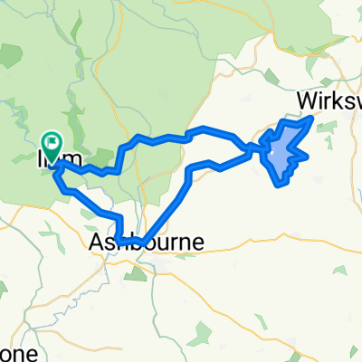
A cycling route starting in Ashbourne, England, United Kingdom.
Overview
About this route
Mostly quiet roads loop, taking in some of the most scenic parts of the western peak district, especially Chrome Hill near Hollinsclough and The Roaches south of Flash. Starts near the National Trust site in Ilam, which has a car park and tea rooms. Sections of the route will be quite exposed, so mind the weather. Plus it's the Peak District and it doesn't stick to the rivers, so be prepared for some hills. Views are worth it though.
- -:--
- Duration
- 66.3 km
- Distance
- 941 m
- Ascent
- 933 m
- Descent
- ---
- Avg. speed
- ---
- Avg. speed
Route quality
Waytypes & surfaces along the route
Waytypes
Quiet road
45.3 km
(68 %)
Road
15.5 km
(23 %)
Surfaces
Paved
16.2 km
(24 %)
Asphalt
16.2 km
(24 %)
Undefined
50.1 km
(76 %)
Continue with Bikemap
Use, edit, or download this cycling route
You would like to ride roachesetc or customize it for your own trip? Here is what you can do with this Bikemap route:
Free features
- Save this route as favorite or in collections
- Copy & plan your own version of this route
- Sync your route with Garmin or Wahoo
Premium features
Free trial for 3 days, or one-time payment. More about Bikemap Premium.
- Navigate this route on iOS & Android
- Export a GPX / KML file of this route
- Create your custom printout (try it for free)
- Download this route for offline navigation
Discover more Premium features.
Get Bikemap PremiumFrom our community
Other popular routes starting in Ashbourne
 C38.5 WPC
- Distance
- 62.3 km
- Ascent
- 355 m
- Descent
- 357 m
- Location
- Ashbourne, England, United Kingdom
 Ashbourne - Alstonefield loop
- Distance
- 26.1 km
- Ascent
- 486 m
- Descent
- 485 m
- Location
- Ashbourne, England, United Kingdom
 Trissington circle
- Distance
- 28 km
- Ascent
- 311 m
- Descent
- 305 m
- Location
- Ashbourne, England, United Kingdom
 tissington trail to high peak trail
- Distance
- 12.9 km
- Ascent
- 219 m
- Descent
- 159 m
- Location
- Ashbourne, England, United Kingdom
 Tissington and High Peak Trails (and the roady thing to join up the ends)
- Distance
- 55.6 km
- Ascent
- 437 m
- Descent
- 437 m
- Location
- Ashbourne, England, United Kingdom
 09.2018 Cov-M'cr-Cov. Dzien 2/3
- Distance
- 59.4 km
- Ascent
- 491 m
- Descent
- 783 m
- Location
- Ashbourne, England, United Kingdom
 ride in the peak district
- Distance
- 50.1 km
- Ascent
- 723 m
- Descent
- 723 m
- Location
- Ashbourne, England, United Kingdom
 Route 10 Carsington Water circular
- Distance
- 43.6 km
- Ascent
- 513 m
- Descent
- 514 m
- Location
- Ashbourne, England, United Kingdom
Open it in the app