
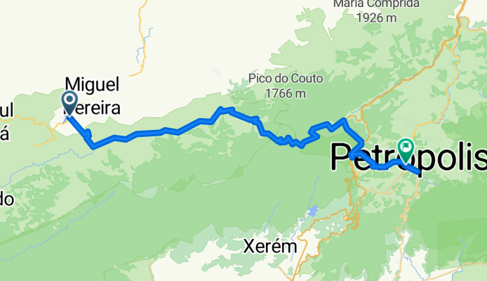
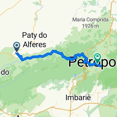
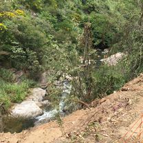
Miguel Pereira ao centro de Petrópolis
A cycling route starting in Miguel Pereira, State of Rio de Janeiro, Brazil.
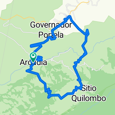
Overview
About this route
- 8 h 9 min
- Duration
- 59 km
- Distance
- 1,240 m
- Ascent
- 1,046 m
- Descent
- 7.2 km/h
- Avg. speed
- ---
- Avg. speed
Route highlights
Points of interest along the route

Point of interest after 7 km
viaduto Paulo de Frontin

Point of interest after 11 km
Início da subida cruel.

Point of interest after 17.6 km
Marcos da Costa

Point of interest after 17.8 km
Vale das Princesas
Continue with Bikemap
Use, edit, or download this cycling route
You would like to ride Miguel Pereira ao centro de Petrópolis or customize it for your own trip? Here is what you can do with this Bikemap route:
Free features
- Save this route as favorite or in collections
- Copy & plan your own version of this route
- Sync your route with Garmin or Wahoo
Premium features
Free trial for 3 days, or one-time payment. More about Bikemap Premium.
- Navigate this route on iOS & Android
- Export a GPX / KML file of this route
- Create your custom printout (try it for free)
- Download this route for offline navigation
Discover more Premium features.
Get Bikemap PremiumFrom our community
Other popular routes starting in Miguel Pereira
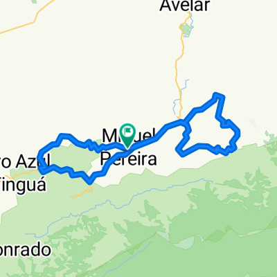 Oito Miguel X Paty
- Distance
- 63.6 km
- Ascent
- 984 m
- Descent
- 988 m
- Location
- Miguel Pereira, State of Rio de Janeiro, Brazil
 MORRO AZUL
- Distance
- 29.1 km
- Ascent
- 1,076 m
- Descent
- 1,037 m
- Location
- Miguel Pereira, State of Rio de Janeiro, Brazil
 Miguel Pereira ao centro de Petrópolis
- Distance
- 59 km
- Ascent
- 1,240 m
- Descent
- 1,046 m
- Location
- Miguel Pereira, State of Rio de Janeiro, Brazil
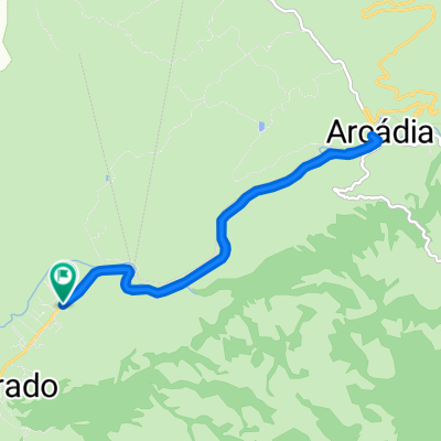
 Arcádia
- Distance
- 20.6 km
- Ascent
- 119 m
- Descent
- 227 m
- Location
- Miguel Pereira, State of Rio de Janeiro, Brazil
 Rua Comandante Paulo Emilio, 3353, Miguel Pereira a Rua Dario Blanco, 160, Miguel Pereira
- Distance
- 4.3 km
- Ascent
- 59 m
- Descent
- 63 m
- Location
- Miguel Pereira, State of Rio de Janeiro, Brazil
 De RJ-125 29845 a RJ-125 29845
- Distance
- 11.8 km
- Ascent
- 126 m
- Descent
- 139 m
- Location
- Miguel Pereira, State of Rio de Janeiro, Brazil
 Rota desde Avenida Laurita, 40, Miguel Pereira
- Distance
- 11.1 km
- Ascent
- 202 m
- Descent
- 152 m
- Location
- Miguel Pereira, State of Rio de Janeiro, Brazil
 Lagoa das Lontras
- Distance
- 35.4 km
- Ascent
- 983 m
- Descent
- 983 m
- Location
- Miguel Pereira, State of Rio de Janeiro, Brazil
Open it in the app