
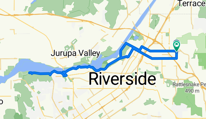
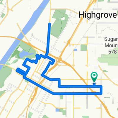
East Riverside to Santa Ana Trail And Back
A cycling route starting in Highgrove, California, United States of America.
Overview
About this route
This ride is really best in late afternoon or early morning. During the middle of the day, unless it's cloudy, keep in mind there's not much rest from the sun, so pack accordingly.
- -:--
- Duration
- 41.3 km
- Distance
- 173 m
- Ascent
- 177 m
- Descent
- ---
- Avg. speed
- ---
- Avg. speed
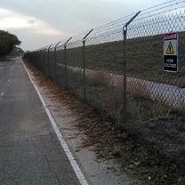
Route photos


Route quality
Waytypes & surfaces along the route
Waytypes
Cycleway
20.9 km
(51 %)
Busy road
8.6 km
(21 %)
Surfaces
Paved
26.9 km
(65 %)
Asphalt
26.8 km
(65 %)
Concrete
0 km
(<1 %)
Undefined
14.5 km
(35 %)
Route highlights
Points of interest along the route
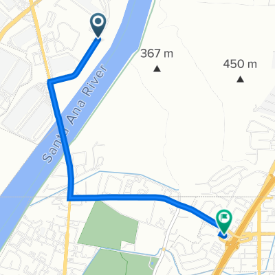
Point of interest after 5.6 km
Very carefully, take the right lane here, as there is no room at all for a bike lane, and there is no sidewalk. Ride Fast! :)
Point of interest after 35.6 km
Take a rest and ride very slowly on the sidewalk, motorists always driving quick here.
Point of interest after 35.9 km
Take the right lane here, its a shared lane. Hold it until the marker after next.
Point of interest after 36.9 km
Guy Who Yells "PUSSY"
Point of interest after 36.9 km
Bike lane begins here.
Continue with Bikemap
Use, edit, or download this cycling route
You would like to ride East Riverside to Santa Ana Trail And Back or customize it for your own trip? Here is what you can do with this Bikemap route:
Free features
- Save this route as favorite or in collections
- Copy & plan your own version of this route
- Sync your route with Garmin or Wahoo
Premium features
Free trial for 3 days, or one-time payment. More about Bikemap Premium.
- Navigate this route on iOS & Android
- Export a GPX / KML file of this route
- Create your custom printout (try it for free)
- Download this route for offline navigation
Discover more Premium features.
Get Bikemap PremiumFrom our community
Other popular routes starting in Highgrove
 Route from 1175 Spring St, Riverside
- Distance
- 76.5 km
- Ascent
- 183 m
- Descent
- 174 m
- Location
- Highgrove, California, United States of America
 East Riverside to Santa Ana Trail And Back
- Distance
- 41.3 km
- Ascent
- 173 m
- Descent
- 177 m
- Location
- Highgrove, California, United States of America
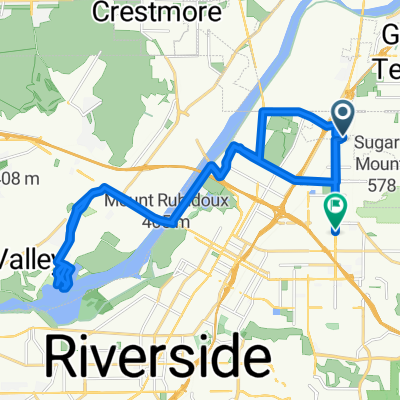
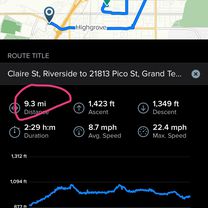 Claire St, Riverside to 21813 Pico St, Grand Terrace
- Distance
- 15 km
- Ascent
- 434 m
- Descent
- 411 m
- Location
- Highgrove, California, United States of America
 Leisure Ride
- Distance
- 19.4 km
- Ascent
- 93 m
- Descent
- 91 m
- Location
- Highgrove, California, United States of America
 Quick ride from Riverside to Moreno Valley
- Distance
- 4.2 km
- Ascent
- 120 m
- Descent
- 0 m
- Location
- Highgrove, California, United States of America
 Miguel Bustamante Parkway 2113, Colton to West La Cadena Drive 319, Riverside
- Distance
- 4 km
- Ascent
- 14 m
- Descent
- 3 m
- Location
- Highgrove, California, United States of America
 Nov 14, 2014, 3:54 PM
- Distance
- 6 km
- Ascent
- 10 m
- Descent
- 11 m
- Location
- Highgrove, California, United States of America
 Kansas Avenue 3016, Riverside to Hardwicke Drive 5526, Riverside
- Distance
- 6.4 km
- Ascent
- 54 m
- Descent
- 82 m
- Location
- Highgrove, California, United States of America
Open it in the app