

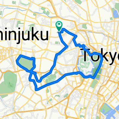
JR池袋駅 to JR有楽町駅(秋葉原経由)
A cycling route starting in Tokyo, Tokyo, Japan.
Overview
About this route
JR Ikebukuro South Exit Station – Harimazaka Park –
- -:--
- Duration
- 15.6 km
- Distance
- 101 m
- Ascent
- 134 m
- Descent
- ---
- Avg. speed
- ---
- Max. altitude

Route highlights
Points of interest along the route
\"")
Point of interest after 4.6 km
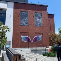
播磨坂公園。偶然見つける。桜祭りの最中である。穏やかな坂に洒落た喫茶などが立ち並ぶ。ラッキーだ。
Point of interest after 10.9 km
インドカレー店で昼食。元会社(ビルの4階30坪)の隣の店。隅田川近くにそして元茶屋町、柳橋ちかくに立地。
Continue with Bikemap
Use, edit, or download this cycling route
You would like to ride JR池袋駅 to JR有楽町駅(秋葉原経由) or customize it for your own trip? Here is what you can do with this Bikemap route:
Free features
- Save this route as favorite or in collections
- Copy & plan your own version of this route
- Sync your route with Garmin or Wahoo
Premium features
Free trial for 3 days, or one-time payment. More about Bikemap Premium.
- Navigate this route on iOS & Android
- Export a GPX / KML file of this route
- Create your custom printout (try it for free)
- Download this route for offline navigation
Discover more Premium features.
Get Bikemap PremiumFrom our community
Other popular routes starting in Tokyo
 Slow ride in Taito-Ku
- Distance
- 9.7 km
- Ascent
- 381 m
- Descent
- 375 m
- Location
- Tokyo, Tokyo, Japan
 Shioiri Park-Skytree-Taito-Ku
- Distance
- 16.6 km
- Ascent
- 820 m
- Descent
- 816 m
- Location
- Tokyo, Tokyo, Japan
 JR御徒町駅 to JR有楽町
- Distance
- 6.7 km
- Ascent
- 90 m
- Descent
- 66 m
- Location
- Tokyo, Tokyo, Japan
 Japedal Stage 1 - Tōkyō to Osaka (Tōkaidō)
- Distance
- 688.4 km
- Ascent
- 6,371 m
- Descent
- 6,372 m
- Location
- Tokyo, Tokyo, Japan
 Day 1 - Japan
- Distance
- 146.3 km
- Ascent
- 476 m
- Descent
- 46 m
- Location
- Tokyo, Tokyo, Japan
 Taito-Odaiba-Kiba Park-Taito
- Distance
- 28.2 km
- Ascent
- 909 m
- Descent
- 916 m
- Location
- Tokyo, Tokyo, Japan
 20-12, Nakaochiai 4-Chōme, Shinjuku to Shinko 1-Chōme, Naka, Yokohama
- Distance
- 43.8 km
- Ascent
- 423 m
- Descent
- 455 m
- Location
- Tokyo, Tokyo, Japan
 Yaraicho, Shinjuku à Yaraicho, Shinjuku
- Distance
- 19.7 km
- Ascent
- 148 m
- Descent
- 151 m
- Location
- Tokyo, Tokyo, Japan
Open it in the app