

Säntis Classic
A cycling route starting in Weinfelden, Thurgau, Switzerland.
Overview
About this route
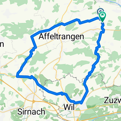
This loop follows the route of the Säntis Classic, an annual challenge that attracts almost 2000 cyclists.
Leaving Weinfelden in Canton Thurgau, the road rises gently in the countryside before descending to Wil. This is where you enter Canton St. Gallen.
The route undulates as it enters the hilly Toggenburg region. At Ebnat-Kappel, you continue to follow the Thur river upstream along the valley’s flank, taking a charming little road that meanders amid the farms away from the traffic.
The main ascent starts at Neu Sankt Johann and consists of a number of ramps (gradient: 7-8%) through the meadows interspersed with level sections. The pass itself is reached at alt. 1278m and offers views of the Säntis (alt. 2502m), the main peak in the regions which can be accessed via aerial cableway. In fine weather, this peak offers views not only of Switzerland, but also of Germany, Austria, Liechtenstein and France!
A rapid descent leads to Urnäsch, after which a series of back roads bring you to Herisau, the capital of Canton Appenzell Ausserrhoden. The 40km return leg to Weinfelden is largely downhill.
- -:--
- Duration
- 123.8 km
- Distance
- 1,204 m
- Ascent
- 1,204 m
- Descent
- ---
- Avg. speed
- ---
- Avg. speed

Route quality
Waytypes & surfaces along the route
Waytypes
Road
38.7 km
(31 %)
Busy road
37.8 km
(30 %)
Surfaces
Paved
93 km
(75 %)
Unpaved
0.1 km
(<1 %)
Asphalt
81.6 km
(66 %)
Paved (undefined)
11.4 km
(9 %)
Continue with Bikemap
Use, edit, or download this cycling route
You would like to ride Säntis Classic or customize it for your own trip? Here is what you can do with this Bikemap route:
Free features
- Save this route as favorite or in collections
- Copy & plan your own version of this route
- Sync your route with Garmin or Wahoo
Premium features
Free trial for 3 days, or one-time payment. More about Bikemap Premium.
- Navigate this route on iOS & Android
- Export a GPX / KML file of this route
- Create your custom printout (try it for free)
- Download this route for offline navigation
Discover more Premium features.
Get Bikemap PremiumFrom our community
Other popular routes starting in Weinfelden
 Ausfahrt durch Bussnang
- Distance
- 21.1 km
- Ascent
- 253 m
- Descent
- 254 m
- Location
- Weinfelden, Thurgau, Switzerland
 säntisClassic 2009
- Distance
- 130.1 km
- Ascent
- 1,884 m
- Descent
- 1,864 m
- Location
- Weinfelden, Thurgau, Switzerland
 Neugutstrasse 2, Weinfelden nach Amriswilerstrasse 54, Weinfelden
- Distance
- 47.5 km
- Ascent
- 609 m
- Descent
- 615 m
- Location
- Weinfelden, Thurgau, Switzerland
 Frauenfeld-Weinfelden
- Distance
- 33.6 km
- Ascent
- 80 m
- Descent
- 80 m
- Location
- Weinfelden, Thurgau, Switzerland
 Relaxed route in Weinfelden
- Distance
- 25.4 km
- Ascent
- 104 m
- Descent
- 104 m
- Location
- Weinfelden, Thurgau, Switzerland
 thurathlon 2013 bike
- Distance
- 29.3 km
- Ascent
- 350 m
- Descent
- 309 m
- Location
- Weinfelden, Thurgau, Switzerland
 Säntis Classic
- Distance
- 130.8 km
- Ascent
- 1,103 m
- Descent
- 1,106 m
- Location
- Weinfelden, Thurgau, Switzerland
 Route in Bussnang
- Distance
- 30.5 km
- Ascent
- 494 m
- Descent
- 492 m
- Location
- Weinfelden, Thurgau, Switzerland
Open it in the app