

Sinzing - Naturfreundehaus Alpiner Steig
A cycling route starting in Sinzing, Bavaria, Germany.
Overview
About this route
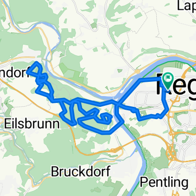
Ab Sinzing Bahnhof über Bruckdorf, Jurasteig, Eilsbrunn. Zurück über Eilsbrunn, Marienhöhe, Kleinprüfening
- -:--
- Duration
- 17.5 km
- Distance
- 292 m
- Ascent
- 292 m
- Descent
- ---
- Avg. speed
- ---
- Avg. speed

Route quality
Waytypes & surfaces along the route
Waytypes
Track
7.6 km
(44 %)
Quiet road
6.1 km
(35 %)
Surfaces
Paved
6.5 km
(37 %)
Unpaved
8.1 km
(46 %)
Asphalt
5.5 km
(32 %)
Gravel
4.8 km
(28 %)
Continue with Bikemap
Use, edit, or download this cycling route
You would like to ride Sinzing - Naturfreundehaus Alpiner Steig or customize it for your own trip? Here is what you can do with this Bikemap route:
Free features
- Save this route as favorite or in collections
- Copy & plan your own version of this route
- Sync your route with Garmin or Wahoo
Premium features
Free trial for 3 days, or one-time payment. More about Bikemap Premium.
- Navigate this route on iOS & Android
- Export a GPX / KML file of this route
- Create your custom printout (try it for free)
- Download this route for offline navigation
Discover more Premium features.
Get Bikemap PremiumFrom our community
Other popular routes starting in Sinzing
 Tour zur großen Bärenhöhle
- Distance
- 17.9 km
- Ascent
- 424 m
- Descent
- 427 m
- Location
- Sinzing, Bavaria, Germany
 Ultimate Trail Regensburg
- Distance
- 27.7 km
- Ascent
- 550 m
- Descent
- 550 m
- Location
- Sinzing, Bavaria, Germany
 Pettendorf - Kallmünz
- Distance
- 28.5 km
- Ascent
- 991 m
- Descent
- 983 m
- Location
- Sinzing, Bavaria, Germany
 Alling, Hohe Wand
- Distance
- 17.2 km
- Ascent
- 346 m
- Descent
- 352 m
- Location
- Sinzing, Bavaria, Germany
 Trailtour
- Distance
- 14.7 km
- Ascent
- 240 m
- Descent
- 239 m
- Location
- Sinzing, Bavaria, Germany
 Regensburg - Kallmuenz
- Distance
- 55.5 km
- Ascent
- 722 m
- Descent
- 815 m
- Location
- Sinzing, Bavaria, Germany
 R-Donau-Laaber-Naab-R
- Distance
- 78.2 km
- Ascent
- 1,025 m
- Descent
- 1,025 m
- Location
- Sinzing, Bavaria, Germany
 Bernhardswalder Runde
- Distance
- 12.4 km
- Ascent
- 258 m
- Descent
- 259 m
- Location
- Sinzing, Bavaria, Germany
Open it in the app