

Mont Salève Snow Traverse
A cycling route starting in Neydens, Auvergne-Rhône-Alpes, France.
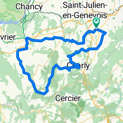
Overview
About this route
Great snow ride first in the frosty clouds then above.
- -:--
- Duration
- 32.6 km
- Distance
- 844 m
- Ascent
- 844 m
- Descent
- ---
- Avg. speed
- ---
- Avg. speed

Route photos


Route quality
Waytypes & surfaces along the route
Waytypes
Road
24.2 km
(74 %)
Quiet road
5.9 km
(18 %)
Surfaces
Paved
13 km
(40 %)
Unpaved
2.2 km
(7 %)
Asphalt
13 km
(40 %)
Gravel
1.9 km
(6 %)
Route highlights
Points of interest along the route
Point of interest after 17.1 km
Col de Plan
Point of interest after 19 km
Col des Pitons (col sign is down the ride a touch higher)
Point of interest after 23.5 km
Col de la Croisette
Continue with Bikemap
Use, edit, or download this cycling route
You would like to ride Mont Salève Snow Traverse or customize it for your own trip? Here is what you can do with this Bikemap route:
Free features
- Save this route as favorite or in collections
- Copy & plan your own version of this route
- Sync your route with Garmin or Wahoo
Premium features
Free trial for 3 days, or one-time payment. More about Bikemap Premium.
- Navigate this route on iOS & Android
- Export a GPX / KML file of this route
- Create your custom printout (try it for free)
- Download this route for offline navigation
Discover more Premium features.
Get Bikemap PremiumFrom our community
Other popular routes starting in Neydens
 Saleve Snow Loop
- Distance
- 39.2 km
- Ascent
- 932 m
- Descent
- 898 m
- Location
- Neydens, Auvergne-Rhône-Alpes, France
 Le Saleve the steep way
- Distance
- 42.8 km
- Ascent
- 1,203 m
- Descent
- 1,134 m
- Location
- Neydens, Auvergne-Rhône-Alpes, France
 Saleve via Col des Pitons
- Distance
- 35.6 km
- Ascent
- 979 m
- Descent
- 952 m
- Location
- Neydens, Auvergne-Rhône-Alpes, France
 Mont Saleve Huts
- Distance
- 15.9 km
- Ascent
- 320 m
- Descent
- 319 m
- Location
- Neydens, Auvergne-Rhône-Alpes, France
 Mont Saleve 1
- Distance
- 33.7 km
- Ascent
- 836 m
- Descent
- 837 m
- Location
- Neydens, Auvergne-Rhône-Alpes, France
 Five Country Loop
- Distance
- 64.8 km
- Ascent
- 589 m
- Descent
- 589 m
- Location
- Neydens, Auvergne-Rhône-Alpes, France
 Circuit Neydens - Valleiry 48 km
- Distance
- 48.5 km
- Ascent
- 709 m
- Descent
- 709 m
- Location
- Neydens, Auvergne-Rhône-Alpes, France
 Le Saleve
- Distance
- 26.1 km
- Ascent
- 1,019 m
- Descent
- 975 m
- Location
- Neydens, Auvergne-Rhône-Alpes, France
Open it in the app