

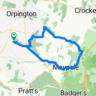
Petts Wood to Woolwich Ferry Via Greenwch Park
A cycling route starting in Orpington, England, United Kingdom.
Overview
About this route
When you get to Eltham Road. I think you can cut through Sutcliffe Park. Which would be a more Green ride. And avoids going through quite so many council estates and Eltham. Middle Park Avenue is not so
- -:--
- Duration
- 27.4 km
- Distance
- 59 m
- Ascent
- 140 m
- Descent
- ---
- Avg. speed
- ---
- Avg. speed

Route quality
Waytypes & surfaces along the route
Waytypes
Quiet road
11.5 km
(42 %)
Cycleway
6.1 km
(22 %)
Surfaces
Paved
20.7 km
(75 %)
Unpaved
0.5 km
(2 %)
Asphalt
18.5 km
(67 %)
Paving stones
1.6 km
(6 %)
Continue with Bikemap
Use, edit, or download this cycling route
You would like to ride Petts Wood to Woolwich Ferry Via Greenwch Park or customize it for your own trip? Here is what you can do with this Bikemap route:
Free features
- Save this route as favorite or in collections
- Copy & plan your own version of this route
- Sync your route with Garmin or Wahoo
Premium features
Free trial for 3 days, or one-time payment. More about Bikemap Premium.
- Navigate this route on iOS & Android
- Export a GPX / KML file of this route
- Create your custom printout (try it for free)
- Download this route for offline navigation
Discover more Premium features.
Get Bikemap PremiumFrom our community
Other popular routes starting in Orpington
 East of orpington
- Distance
- 43.2 km
- Ascent
- 433 m
- Descent
- 440 m
- Location
- Orpington, England, United Kingdom
 Orpington 28km
- Distance
- 28.4 km
- Ascent
- 430 m
- Descent
- 428 m
- Location
- Orpington, England, United Kingdom
 Avalon Road 146 to Avalon Road 152
- Distance
- 17.7 km
- Ascent
- 183 m
- Descent
- 184 m
- Location
- Orpington, England, United Kingdom
 45km lap of Sevenoaks
- Distance
- 47.2 km
- Ascent
- 489 m
- Descent
- 495 m
- Location
- Orpington, England, United Kingdom
 Orps to Chips
- Distance
- 14.8 km
- Ascent
- 206 m
- Descent
- 207 m
- Location
- Orpington, England, United Kingdom
 80 Poverest Road, Orpington to 147 Poverest Road, Orpington
- Distance
- 25.2 km
- Ascent
- 84 m
- Descent
- 120 m
- Location
- Orpington, England, United Kingdom
 MTB-Biggin Hill loop 60 km
- Distance
- 62.3 km
- Ascent
- 726 m
- Descent
- 726 m
- Location
- Orpington, England, United Kingdom
 skeet
skeet- Distance
- 10.5 km
- Ascent
- 132 m
- Descent
- 128 m
- Location
- Orpington, England, United Kingdom
Open it in the app