

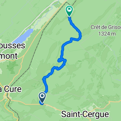
Morez-Mouthe-Mollendruz
A cycling route starting in Saint-Cergue, Canton of Vaud, Switzerland.
Overview
About this route
Jolie boucle jurassienne sur route, au départ de La Cure (accessible en train depuis Nyon). Le parcours plonge dans la vallée de la Bienne, avant de remonter vers la Combe des Cives via Bellefontaine. Après quelques kilomètres dans le Val de Mouthe, nouvelle montée, vers le col de Landoz-Neuve cette fois, pour revenir en Suisse. Troisième et dernière montée de la journée, le col du Mollendruz nous ramène à proximité du bassin lémanique. Fin de balade à travers le vignoble entre Aubonne et Rolle.
Distance : 105 km
Dénivelé positif : 1300 m
Altitude maximale : 1260 m (col de Landoz-Neuve)
Plus d'informations sur www.europebybike.info
- -:--
- Duration
- 104 km
- Distance
- 1,060 m
- Ascent
- 1,795 m
- Descent
- ---
- Avg. speed
- ---
- Avg. speed

Route quality
Waytypes & surfaces along the route
Waytypes
Road
61.9 km
(60 %)
Busy road
35.1 km
(34 %)
Surfaces
Paved
65.9 km
(63 %)
Unpaved
0.1 km
(<1 %)
Asphalt
64.9 km
(62 %)
Paved (undefined)
1 km
(<1 %)
Continue with Bikemap
Use, edit, or download this cycling route
You would like to ride Morez-Mouthe-Mollendruz or customize it for your own trip? Here is what you can do with this Bikemap route:
Free features
- Save this route as favorite or in collections
- Copy & plan your own version of this route
- Sync your route with Garmin or Wahoo
Premium features
Free trial for 3 days, or one-time payment. More about Bikemap Premium.
- Navigate this route on iOS & Android
- Export a GPX / KML file of this route
- Create your custom printout (try it for free)
- Download this route for offline navigation
Discover more Premium features.
Get Bikemap PremiumFrom our community
Other popular routes starting in Saint-Cergue
 2020 - Gorets - J3 - P1
- Distance
- 11.9 km
- Ascent
- 459 m
- Descent
- 366 m
- Location
- Saint-Cergue, Canton of Vaud, Switzerland
 St Cergue - Grutli - Les Fruitieres de Nyon
- Distance
- 24.8 km
- Ascent
- 653 m
- Descent
- 610 m
- Location
- Saint-Cergue, Canton of Vaud, Switzerland
 Bourg-en-Bresse - Les Rousses
- Distance
- 179 km
- Ascent
- 1,894 m
- Descent
- 2,728 m
- Location
- Saint-Cergue, Canton of Vaud, Switzerland
 sommet baudichone - givrine
- Distance
- 8.1 km
- Ascent
- 187 m
- Descent
- 378 m
- Location
- Saint-Cergue, Canton of Vaud, Switzerland
 St Cergue - Grutli - Les Fruitieres de Nyon
- Distance
- 24.8 km
- Ascent
- 503 m
- Descent
- 506 m
- Location
- Saint-Cergue, Canton of Vaud, Switzerland
 France Ultime : Belfort - Les Rousses
- Distance
- 214.3 km
- Ascent
- 1,500 m
- Descent
- 2,208 m
- Location
- Saint-Cergue, Canton of Vaud, Switzerland
 Untitled route
- Distance
- 62.9 km
- Ascent
- 1,360 m
- Descent
- 1,871 m
- Location
- Saint-Cergue, Canton of Vaud, Switzerland
 retour st cergues le Muids Nyon
- Distance
- 19.9 km
- Ascent
- 50 m
- Descent
- 707 m
- Location
- Saint-Cergue, Canton of Vaud, Switzerland
Open it in the app