

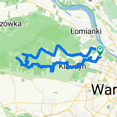
Przez Puszczę do Niepokalanowa
A cycling route starting in Bielany, Masovian Voivodeship, Poland.
Overview
About this route
- -:--
- Duration
- 47.5 km
- Distance
- 82 m
- Ascent
- 94 m
- Descent
- ---
- Avg. speed
- ---
- Max. altitude

Route quality
Waytypes & surfaces along the route
Waytypes
Track
23.8 km
(50 %)
Road
9.5 km
(20 %)
Surfaces
Paved
13.8 km
(29 %)
Unpaved
27.1 km
(57 %)
Ground
16.2 km
(34 %)
Asphalt
13.8 km
(29 %)
Route highlights
Points of interest along the route
Point of interest after 7 km
Rezerwat Ochrony Ścisłej Sieraków
Point of interest after 13.1 km
Cmentarz Palmiry
Point of interest after 19.6 km
Cmentarz partyzancki
Point of interest after 30.6 km
Karpaty :)

Point of interest after 40.3 km
Kościół w Kampinosie

Point of interest after 47.4 km
Bazylika w Niepokalanowie
Continue with Bikemap
Use, edit, or download this cycling route
You would like to ride Przez Puszczę do Niepokalanowa or customize it for your own trip? Here is what you can do with this Bikemap route:
Free features
- Save this route as favorite or in collections
- Copy & plan your own version of this route
- Sync your route with Garmin or Wahoo
Premium features
Free trial for 3 days, or one-time payment. More about Bikemap Premium.
- Navigate this route on iOS & Android
- Export a GPX / KML file of this route
- Create your custom printout (try it for free)
- Download this route for offline navigation
Discover more Premium features.
Get Bikemap PremiumFrom our community
Other popular routes starting in Bielany
 propozycja trasy na srode
- Distance
- 16.4 km
- Ascent
- 68 m
- Descent
- 53 m
- Location
- Bielany, Masovian Voivodeship, Poland
 Pętla Nowodworska
- Distance
- 83.8 km
- Ascent
- 81 m
- Descent
- 80 m
- Location
- Bielany, Masovian Voivodeship, Poland
 Narew i wisła
- Distance
- 71.4 km
- Ascent
- 91 m
- Descent
- 90 m
- Location
- Bielany, Masovian Voivodeship, Poland
 Przez Puszczę do Niepokalanowa
- Distance
- 47.5 km
- Ascent
- 82 m
- Descent
- 94 m
- Location
- Bielany, Masovian Voivodeship, Poland
 65 km
65 km- Distance
- 64.6 km
- Ascent
- 71 m
- Descent
- 69 m
- Location
- Bielany, Masovian Voivodeship, Poland
 Kampinos 150km
- Distance
- 144.6 km
- Ascent
- 88 m
- Descent
- 88 m
- Location
- Bielany, Masovian Voivodeship, Poland
 Tour de Bia-Te 2011
- Distance
- 638.3 km
- Ascent
- 347 m
- Descent
- 343 m
- Location
- Bielany, Masovian Voivodeship, Poland
 Petla Mlociny - Kampinos
- Distance
- 55.4 km
- Ascent
- 138 m
- Descent
- 138 m
- Location
- Bielany, Masovian Voivodeship, Poland
Open it in the app