
Dayboro - Ocean View
A cycling route starting in Samford Valley, Queensland, Australia.
Overview
About this route
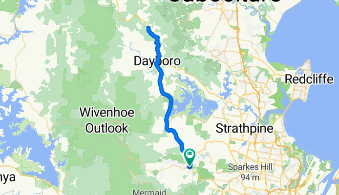
Mt Samson Rd from Samford to Dayboro then up Mt Mee Rd to Townsend Rd at the top of the 8km climb. Back to Samford the same way.
- -:--
- Duration
- 64.5 km
- Distance
- 691 m
- Ascent
- 681 m
- Descent
- ---
- Avg. speed
- 422 m
- Avg. speed

Route quality
Waytypes & surfaces along the route
Waytypes
Busy road
49.6 km
(77 %)
Access road
4 km
(6 %)
Surfaces
Paved
58.5 km
(91 %)
Paved (undefined)
29.6 km
(46 %)
Asphalt
26.4 km
(41 %)
Continue with Bikemap
Use, edit, or download this cycling route
You would like to ride Dayboro - Ocean View or customize it for your own trip? Here is what you can do with this Bikemap route:
Free features
- Save this route as favorite or in collections
- Copy & plan your own version of this route
- Sync your route with Garmin or Wahoo
Premium features
Free trial for 3 days, or one-time payment. More about Bikemap Premium.
- Navigate this route on iOS & Android
- Export a GPX / KML file of this route
- Create your custom printout (try it for free)
- Download this route for offline navigation
Discover more Premium features.
Get Bikemap PremiumFrom our community
Other popular routes starting in Samford Valley
 Sandgate via Jinker
- Distance
- 60.1 km
- Ascent
- 340 m
- Descent
- 338 m
- Location
- Samford Valley, Queensland, Australia
 Samford to Sandgate - Original
- Distance
- 58.8 km
- Ascent
- 340 m
- Descent
- 338 m
- Location
- Samford Valley, Queensland, Australia
 Winn Rd Hills District circuit
- Distance
- 46.8 km
- Ascent
- 386 m
- Descent
- 372 m
- Location
- Samford Valley, Queensland, Australia
 Kedron Brook Bikeway - Nudgee Beach
- Distance
- 74.7 km
- Ascent
- 678 m
- Descent
- 679 m
- Location
- Samford Valley, Queensland, Australia
 Tour de Hills
- Distance
- 35.1 km
- Ascent
- 550 m
- Descent
- 547 m
- Location
- Samford Valley, Queensland, Australia
 Samford to Sandgate
- Distance
- 62.3 km
- Ascent
- 415 m
- Descent
- 411 m
- Location
- Samford Valley, Queensland, Australia
 Cedar Creek - Long
- Distance
- 36.2 km
- Ascent
- 446 m
- Descent
- 449 m
- Location
- Samford Valley, Queensland, Australia
 Dayboro - Mt Pleasant
- Distance
- 70.5 km
- Ascent
- 585 m
- Descent
- 573 m
- Location
- Samford Valley, Queensland, Australia
Open it in the app