

Rund um die Kampenwand
A cycling route starting in Aschau im Chiemgau, Bavaria, Germany.
Overview
About this route
von Aschau auf einem Radweg leicht ansteigend bis hinter Sachrang, dort abzweigend nach Rettenschöss länger bergab. Am Walchsee Bademöglichkeit und beschilderter Radweg bis Kössen. ein kurzes Stück bergauf an der Klamm bei Klobenstein auf der Strasse. Wieder bergab bis Ettenhausen. Dort Abzweigen und iweder auf Radwegen über Schleching, Mettenham (Gasthaus Birner mit schönem Biergarten) bis Marquartstein. In GRassau wieder auf Radweg an der Strasse bis Bernau. Zuletzt ein Ansteig am Bernauer Berg
- -:--
- Duration
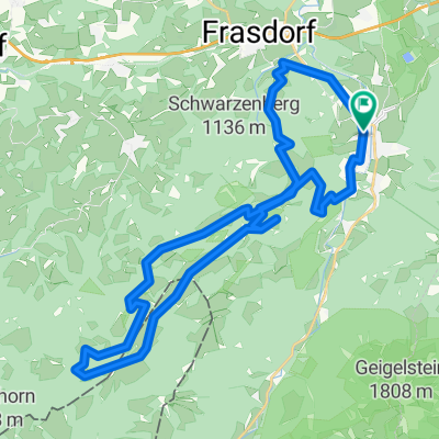
- 58.3 km
- Distance
- 450 m
- Ascent
- 494 m
- Descent
- ---
- Avg. speed
- 766 m
- Avg. speed
Route quality
Waytypes & surfaces along the route
Waytypes
Quiet road
24.7 km
(42 %)
Busy road
10.1 km
(17 %)
Surfaces
Paved
50.5 km
(87 %)
Unpaved
3.1 km
(5 %)
Asphalt
49.8 km
(85 %)
Gravel
1.4 km
(2 %)
Continue with Bikemap
Use, edit, or download this cycling route
You would like to ride Rund um die Kampenwand or customize it for your own trip? Here is what you can do with this Bikemap route:
Free features
- Save this route as favorite or in collections
- Copy & plan your own version of this route
- Sync your route with Garmin or Wahoo
Premium features
Free trial for 3 days, or one-time payment. More about Bikemap Premium.
- Navigate this route on iOS & Android
- Export a GPX / KML file of this route
- Create your custom printout (try it for free)
- Download this route for offline navigation
Discover more Premium features.
Get Bikemap PremiumFrom our community
Other popular routes starting in Aschau im Chiemgau
 Kampenwand
- Distance
- 16.9 km
- Ascent
- 969 m
- Descent
- 970 m
- Location
- Aschau im Chiemgau, Bavaria, Germany
 Rund um den Geigelstein
- Distance
- 41.4 km
- Ascent
- 838 m
- Descent
- 838 m
- Location
- Aschau im Chiemgau, Bavaria, Germany
 Aschau-Wössnersee-Runde
- Distance
- 53.1 km
- Ascent
- 295 m
- Descent
- 303 m
- Location
- Aschau im Chiemgau, Bavaria, Germany
 Schachenberg
- Distance
- 4.4 km
- Ascent
- 379 m
- Descent
- 376 m
- Location
- Aschau im Chiemgau, Bavaria, Germany
 Kampenwand
- Distance
- 8 km
- Ascent
- 884 m
- Descent
- 77 m
- Location
- Aschau im Chiemgau, Bavaria, Germany
 Hochries Umrundung
- Distance
- 36.1 km
- Ascent
- 1,229 m
- Descent
- 1,229 m
- Location
- Aschau im Chiemgau, Bavaria, Germany
 Kitzbüheler Horn
- Distance
- 130.3 km
- Ascent
- 1,707 m
- Descent
- 1,707 m
- Location
- Aschau im Chiemgau, Bavaria, Germany
 Sudelfeldpass
- Distance
- 98.3 km
- Ascent
- 1,405 m
- Descent
- 1,405 m
- Location
- Aschau im Chiemgau, Bavaria, Germany
Open it in the app