

Aschachrunde S/Z Kremstalerhof
A cycling route starting in Leonding, Upper Austria, Austria.
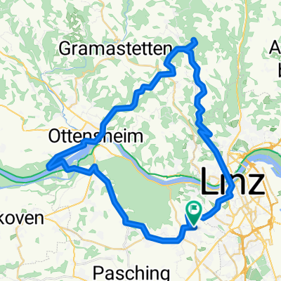
Overview
About this route
RR
Variante:
Zur Dörnbacherstraße (Keisverkehr & SPAR) kann man auch über die Untere Bahnstraße (entlang der Bahn) fahren. Beim Paschinger Bahnhof durch die Unterführung und im Kreisverkehr gerade (2 Ausfahrt) in die Dörnbacherstraße. Weiter bis zum zweiten Kreisverkehr (Spar ist auf der rechten Seite) gerade aus drüber.
Wissenswertes zur Srecke:
Wenn man von Polsing rauf nach Forst zum Spitzwirt fährt, gehts gleich nach dem Wirtshaus LINKS für ca. 300m auf einem Unbefestigten Weg weiter.
Wer den Berg nicht fahren will kann auch von Polsing aus auf dem R18 bleiben. Geht immer gerade aus und man kommt am Ende der Staße wieder auf die geplante Route.
PS:
DIE ROUTE KANN IN BEIDE RICHTUNGEN GEFAHREN WERDEN!!!
- -:--
- Duration
- 73.3 km
- Distance
- 270 m
- Ascent
- 270 m
- Descent
- ---
- Avg. speed
- ---
- Avg. speed

Continue with Bikemap
Use, edit, or download this cycling route
You would like to ride Aschachrunde S/Z Kremstalerhof or customize it for your own trip? Here is what you can do with this Bikemap route:
Free features
- Save this route as favorite or in collections
- Copy & plan your own version of this route
- Sync your route with Garmin or Wahoo
Premium features
Free trial for 3 days, or one-time payment. More about Bikemap Premium.
- Navigate this route on iOS & Android
- Export a GPX / KML file of this route
- Create your custom printout (try it for free)
- Download this route for offline navigation
Discover more Premium features.
Get Bikemap PremiumFrom our community
Other popular routes starting in Leonding
 Leonding-Gis-Kirchschlag-Helmonsödt-Pelmberg-Leonding
- Distance
- 49.4 km
- Ascent
- 1,254 m
- Descent
- 1,286 m
- Location
- Leonding, Upper Austria, Austria
 Trail Kürnbergburg – Rufling
- Distance
- 1.8 km
- Ascent
- 25 m
- Descent
- 195 m
- Location
- Leonding, Upper Austria, Austria
 Linz - Wallsee - Linz
- Distance
- 88.4 km
- Ascent
- 95 m
- Descent
- 95 m
- Location
- Leonding, Upper Austria, Austria
 Trail Friesenegg – Freinberg
- Distance
- 1.7 km
- Ascent
- 15 m
- Descent
- 58 m
- Location
- Leonding, Upper Austria, Austria
 RR10_2015_06_10-Traunweg Nord-Marchtr.
- Distance
- 41.4 km
- Ascent
- 60 m
- Descent
- 58 m
- Location
- Leonding, Upper Austria, Austria
 RR19-20150824_140332.gpx
- Distance
- 57.1 km
- Ascent
- 137 m
- Descent
- 137 m
- Location
- Leonding, Upper Austria, Austria
 Prinzensteig
- Distance
- 9.4 km
- Ascent
- 404 m
- Descent
- 404 m
- Location
- Leonding, Upper Austria, Austria
 Leonding-Gis-Ottensheim-Leonding
- Distance
- 45.6 km
- Ascent
- 842 m
- Descent
- 835 m
- Location
- Leonding, Upper Austria, Austria
Open it in the app