

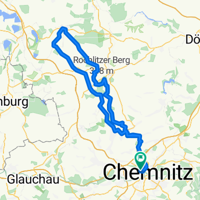
Chemnitz-Markersdorf-Chemnitz
A cycling route starting in Chemnitz, Saxony, Germany.
Overview
About this route
Rundweg von der Zwickauer Straße zum Chemnitztalradweg über Markersdorf, Claußnitz, Ottendorf, Garnsdorf, Auerswalde, Glösa, wieder auf den Chemnitztalradweg bis Nordstraße/Eckstraße
- -:--
- Duration
- 66.9 km
- Distance
- 296 m
- Ascent
- 316 m
- Descent
- ---
- Avg. speed
- ---
- Avg. speed
Route quality
Waytypes & surfaces along the route
Waytypes
Cycleway
27.4 km
(41 %)
Quiet road
16 km
(24 %)
Surfaces
Paved
62.5 km
(93 %)
Unpaved
0.3 km
(<1 %)
Asphalt
55.1 km
(82 %)
Paving stones
6 km
(9 %)
Route highlights
Points of interest along the route
Point of interest after 0.4 km
Start Radtour Lidl Parkplatz

Point of interest after 21.7 km
Gaststätte Roter Hirsch - Mittagspause

Point of interest after 35.6 km
Eiscafe Glösa - Kaffee/Kuchen/Eis, Pause
Point of interest after 66.1 km
Endpunkt der Radtour - individuelle Heimreise
Continue with Bikemap
Use, edit, or download this cycling route
You would like to ride Chemnitz-Markersdorf-Chemnitz or customize it for your own trip? Here is what you can do with this Bikemap route:
Free features
- Save this route as favorite or in collections
- Copy & plan your own version of this route
- Sync your route with Garmin or Wahoo
Premium features
Free trial for 3 days, or one-time payment. More about Bikemap Premium.
- Navigate this route on iOS & Android
- Export a GPX / KML file of this route
- Create your custom printout (try it for free)
- Download this route for offline navigation
Discover more Premium features.
Get Bikemap PremiumFrom our community
Other popular routes starting in Chemnitz
 Raben-Küch-Wald-Fetzt-Runde
- Distance
- 28.8 km
- Ascent
- 246 m
- Descent
- 254 m
- Location
- Chemnitz, Saxony, Germany
 Raben-Toten-Hohen-stein-Runde
- Distance
- 41.4 km
- Ascent
- 393 m
- Descent
- 397 m
- Location
- Chemnitz, Saxony, Germany
 4h Runde Chemnitz
- Distance
- 107.7 km
- Ascent
- 582 m
- Descent
- 572 m
- Location
- Chemnitz, Saxony, Germany
 Goldner Hahn _ Wasserschloß
- Distance
- 34.3 km
- Ascent
- 670 m
- Descent
- 675 m
- Location
- Chemnitz, Saxony, Germany
 Chemnitz - Kohren Salis
- Distance
- 96.3 km
- Ascent
- 522 m
- Descent
- 526 m
- Location
- Chemnitz, Saxony, Germany
 Zschopextreme
- Distance
- 47.7 km
- Ascent
- 675 m
- Descent
- 677 m
- Location
- Chemnitz, Saxony, Germany
 West- Nord- Runde (Grüna, Glöse, ...)
- Distance
- 49.8 km
- Ascent
- 339 m
- Descent
- 339 m
- Location
- Chemnitz, Saxony, Germany
 Chemnitz - Rochlitzer Berg - Bad Lausick - Chemnitz 2
- Distance
- 108.4 km
- Ascent
- 546 m
- Descent
- 543 m
- Location
- Chemnitz, Saxony, Germany
Open it in the app