

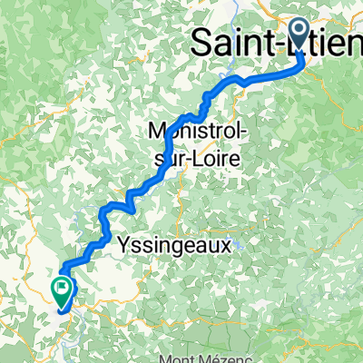
j.13 08.07.2016 St. Ettienne bis Le Puy
A cycling route starting in Saint-Etienne, Auvergne-Rhône-Alpes, France.
Overview
About this route
- -:--
- Duration
- 90 km
- Distance
- 913 m
- Ascent
- 799 m
- Descent
- ---
- Avg. speed
- ---
- Max. altitude

Route quality
Waytypes & surfaces along the route
Waytypes
Quiet road
22.5 km
(25 %)
Road
3.6 km
(4 %)
Surfaces
Paved
45.9 km
(51 %)
Unpaved
1.8 km
(2 %)
Asphalt
45.9 km
(51 %)
Unpaved (undefined)
0.9 km
(1 %)
Continue with Bikemap
Use, edit, or download this cycling route
You would like to ride j.13 08.07.2016 St. Ettienne bis Le Puy or customize it for your own trip? Here is what you can do with this Bikemap route:
Free features
- Save this route as favorite or in collections
- Copy & plan your own version of this route
- Split it into stages to create a multi-day tour
- Sync your route with Garmin or Wahoo
Premium features
Free trial for 3 days, or one-time payment. More about Bikemap Premium.
- Navigate this route on iOS & Android
- Export a GPX / KML file of this route
- Create your custom printout (try it for free)
- Download this route for offline navigation
Discover more Premium features.
Get Bikemap PremiumFrom our community
Other popular routes starting in Saint-Etienne
 Tour de Chambles
- Distance
- 49.3 km
- Ascent
- 612 m
- Descent
- 725 m
- Location
- Saint-Etienne, Auvergne-Rhône-Alpes, France
 B: St.Étienne-Murat (Pas de Peyrol) 2.Etappe: Genf-Bordeaux:
- Distance
- 188.9 km
- Ascent
- 2,243 m
- Descent
- 1,732 m
- Location
- Saint-Etienne, Auvergne-Rhône-Alpes, France
 balade urbaine OciVelocio
- Distance
- 10.5 km
- Ascent
- 82 m
- Descent
- 81 m
- Location
- Saint-Etienne, Auvergne-Rhône-Alpes, France
 châteaucreux-office-MAI-mine-design-stade-plaine-achille-châteucreux
- Distance
- 10.6 km
- Ascent
- 76 m
- Descent
- 75 m
- Location
- Saint-Etienne, Auvergne-Rhône-Alpes, France
 St. Etienne nach LePuy
- Distance
- 80.5 km
- Ascent
- 1,111 m
- Descent
- 971 m
- Location
- Saint-Etienne, Auvergne-Rhône-Alpes, France
 2016 Ride Day 141 - Saint-Etienne to Roanne
- Distance
- 96.1 km
- Ascent
- 432 m
- Descent
- 744 m
- Location
- Saint-Etienne, Auvergne-Rhône-Alpes, France
 GV19 st-étienne - le puy
- Distance
- 84.8 km
- Ascent
- 916 m
- Descent
- 828 m
- Location
- Saint-Etienne, Auvergne-Rhône-Alpes, France
 Retournac
- Distance
- 127.7 km
- Ascent
- 1,227 m
- Descent
- 1,245 m
- Location
- Saint-Etienne, Auvergne-Rhône-Alpes, France
Open it in the app