

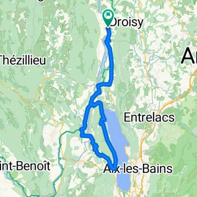
Col de la Biche and Grand Colombier (the steep way)
A cycling route starting in Versonnex, Auvergne-Rhône-Alpes, France.
Overview
About this route
Following the 2017 Tour de France route. 1st time climbing Biche, and 1st time up the steepest side of Grand Colombier.
- -:--
- Duration
- 68.9 km
- Distance
- 2,430 m
- Ascent
- 2,430 m
- Descent
- ---
- Avg. speed
- ---
- Avg. speed

Route highlights
Points of interest along the route
Point of interest after 16.3 km
Golet de la Biche
Point of interest after 38.5 km
Col du Grand Colombier
Point of interest after 51.9 km
avalanche
Point of interest after 53.3 km
Les Lacets du Grand Colombier
Continue with Bikemap
Use, edit, or download this cycling route
You would like to ride Col de la Biche and Grand Colombier (the steep way) or customize it for your own trip? Here is what you can do with this Bikemap route:
Free features
- Save this route as favorite or in collections
- Copy & plan your own version of this route
- Sync your route with Garmin or Wahoo
Premium features
Free trial for 3 days, or one-time payment. More about Bikemap Premium.
- Navigate this route on iOS & Android
- Export a GPX / KML file of this route
- Create your custom printout (try it for free)
- Download this route for offline navigation
Discover more Premium features.
Get Bikemap PremiumFrom our community
Other popular routes starting in Versonnex
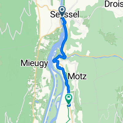 8 Quai du Rhône, Seyssel to 155 Rue Stéphane Duc, Serrières-en-Chautagne
- Distance
- 8.2 km
- Ascent
- 96 m
- Descent
- 90 m
- Location
- Versonnex, Auvergne-Rhône-Alpes, France
 J-2: Back sur la Via Rhona
- Distance
- 83 km
- Ascent
- 149 m
- Descent
- 198 m
- Location
- Versonnex, Auvergne-Rhône-Alpes, France
 étape 3 jours 1
- Distance
- 35.2 km
- Ascent
- 214 m
- Descent
- 235 m
- Location
- Versonnex, Auvergne-Rhône-Alpes, France
 Via Rhona Seyssel/Chanaz/Belley
- Distance
- 33.2 km
- Ascent
- 81 m
- Descent
- 103 m
- Location
- Versonnex, Auvergne-Rhône-Alpes, France
 GTJG 5 NOK_Seyssel-Cluses
- Distance
- 103.4 km
- Ascent
- 3,818 m
- Descent
- 3,583 m
- Location
- Versonnex, Auvergne-Rhône-Alpes, France
 Tour du lac du Bourget (89km)
- Distance
- 89.3 km
- Ascent
- 1,656 m
- Descent
- 1,657 m
- Location
- Versonnex, Auvergne-Rhône-Alpes, France
 Le Tour du Chat
- Distance
- 85.1 km
- Ascent
- 608 m
- Descent
- 610 m
- Location
- Versonnex, Auvergne-Rhône-Alpes, France
 Genf-Lyon 2. Etappe
- Distance
- 69.4 km
- Ascent
- 402 m
- Descent
- 430 m
- Location
- Versonnex, Auvergne-Rhône-Alpes, France
Open it in the app