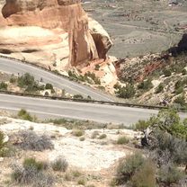
Colorado National Monument Circle from Grand Junction
A cycling route starting in Fruitvale, Colorado, United States of America.
Overview
About this route
This was one great ride through the Colorado Nat'l Monument. Our second time; last time was in the mid-1980s. Perfect weather and countryside and views that must be the best in the U.S.
Inside the park, there was little traffic. The other roads were either low traffic or they mostly had bike lanes.
We highly recommend this ride.
- -:--
- Duration
- 80.2 km
- Distance
- 864 m
- Ascent
- 863 m
- Descent
- ---
- Avg. speed
- ---
- Avg. speed
Route photos
Route quality
Waytypes & surfaces along the route
Waytypes
Busy road
55.9 km
(70 %)
Pedestrian area
8.6 km
(11 %)
Surfaces
Paved
79 km
(98 %)
Unpaved
0.2 km
(<1 %)
Asphalt
62.6 km
(78 %)
Concrete
15.8 km
(20 %)
Continue with Bikemap
Use, edit, or download this cycling route
You would like to ride Colorado National Monument Circle from Grand Junction or customize it for your own trip? Here is what you can do with this Bikemap route:
Free features
- Save this route as favorite or in collections
- Copy & plan your own version of this route
- Sync your route with Garmin or Wahoo
Premium features
Free trial for 3 days, or one-time payment. More about Bikemap Premium.
- Navigate this route on iOS & Android
- Export a GPX / KML file of this route
- Create your custom printout (try it for free)
- Download this route for offline navigation
Discover more Premium features.
Get Bikemap PremiumFrom our community
Other popular routes starting in Fruitvale
 361 32 Rd, Grand Junction to Riverfront Trail, Grand Junction
- Distance
- 13 km
- Ascent
- 12 m
- Descent
- 25 m
- Location
- Fruitvale, Colorado, United States of America
 Colorado National Monument Circle from Grand Junction
- Distance
- 80.2 km
- Ascent
- 864 m
- Descent
- 863 m
- Location
- Fruitvale, Colorado, United States of America
 Morning Dove Court 452, Grand Junction to Morning Dove Drive 453, Grand Junction
- Distance
- 6.4 km
- Ascent
- 34 m
- Descent
- 35 m
- Location
- Fruitvale, Colorado, United States of America
 Colorado/Utah, Grand Junction - Clorado Springs
- Distance
- 1,415.6 km
- Ascent
- 18,076 m
- Descent
- 17,902 m
- Location
- Fruitvale, Colorado, United States of America
 exploring East trail
- Distance
- 17.4 km
- Ascent
- 82 m
- Descent
- 68 m
- Location
- Fruitvale, Colorado, United States of America
 Route to 1625 Riverfront Dr, Grand Junction
- Distance
- 7.2 km
- Ascent
- 0 m
- Descent
- 9 m
- Location
- Fruitvale, Colorado, United States of America
 632 Kings Glen Loop, Grand Junction to 565 28 1/4 Rd, Grand Junction
- Distance
- 5.4 km
- Ascent
- 167 m
- Descent
- 191 m
- Location
- Fruitvale, Colorado, United States of America
 2928 Lamlash Way, Grand Junction to 2929 Lamlash Way, Grand Junction
- Distance
- 3.3 km
- Ascent
- 2,027 m
- Descent
- 1,951 m
- Location
- Fruitvale, Colorado, United States of America
Open it in the app


